
- elevation 1,569 ft (478 m) Length 206 km Mouth Tolovana River | - elevation 302 ft (92 m) Country United States of America | |
 | ||
- location 48 miles (77 km) northwest of Fairbanks, Yukon–Koyukuk Census Area | ||
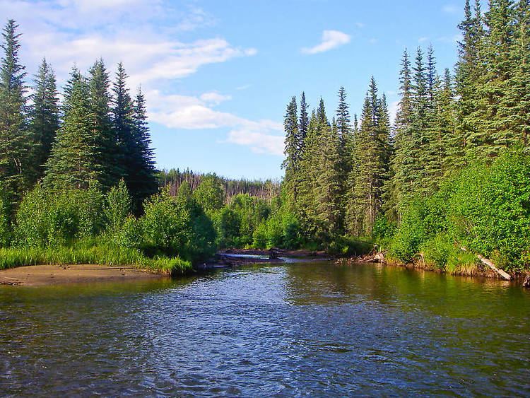
The Chatanika River is a 128-mile (206 km) tributary of the Tolovana River in the U.S. state of Alaska. The Chatanika River is a clear or lightly tannic stained rapid-runoff stream that has its headwaters in the mountains of the northeastern portion of the Alaska Range and flows westward through valleys between summits and uplands for about four-fifths of its length before it enters Minto Flats. Once in the flats—a marshy area in which multiple streams, rivers, and lakes are located— the Chatanika joins the Tolovana, which flows into the Tanana River and on to the Yukon River. The Chatanika is thus a portion of the Yukon River drainage basin.
Contents
Map of Chatanika River, Alaska, USA
During the first portion of the 20th century, the Chatanika was dominated by the gold-mining industry, which used its flow to operate gold dredges. The most visible example of this was the construction of the Davidson Ditch, a dam-and-pipeline system used to divert water to gold-mining operations closer to Fairbanks. The Ditch was abandoned in the 1950s, and during the 1967 Tanana Valley flood, the dam was damaged and became inoperable. In January 2002, the Alaska Department of Fish and Game and the United States Fish and Wildlife Service removed the dam in conjunction with other groups, restoring the Chatanika's original flow. Today, the upper Chatanika is a moderately popular rafting and fishing destination, and vacation cabins have been built at spots along its banks.
Chatanika, Alaska, located near the river, shares its name with the river.
The river contains Arctic grayling, Arctic lamprey, burbot, chum salmon, humpback whitefish, king salmon, least cisco, longnose suckers, northern pike, sheefish, and slimy sculpins.
Boating
Boaters can float the Chatanika River in many kinds of non-motorized watercraft. The Elliott Highway, which crosses the river below the village of Chatanika, and the Steese Highway, which parallels the river further upstream, offer multiple places to begin and end boating trips. Several public campgrounds and waysides along these highways afford access to the river. The entire river is rated Class I (easy) on the International Scale of River Difficulty. Dangers include logjams and overhanging trees and stumps.