
 | ||
The Charlottesville Metropolitan Statistical Area is a Metropolitan Statistical Area (MSA) in Virginia as defined by the United States Office of Management and Budget (OMB). As of 2012, the Charlottesville MSA had a population of 206,615.
Contents
MSA components
Note: Since a state constitutional change in 1871, all cities in Virginia are independent cities that are not located in any county. The OMB considers these independent cities to be county-equivalents for the purpose of defining MSAs in Virginia.
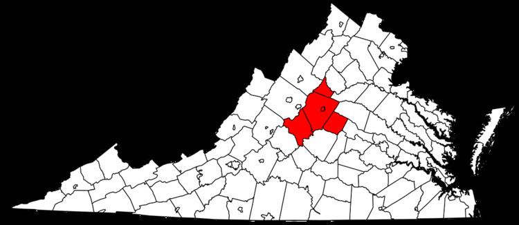
Four counties and one independent city are included in the Charlottesville Metropolitan Statistical Area.
Places with more than 40,000 inhabitants
Places with 1,000 to 10,000 inhabitants
Places with less than 1,000 inhabitants
Demographics
As of the census of 2000, there were 174,021 people, 67,575 households, and 42,840 families residing within the MSA. The racial makeup of the MSA was 80.77% White, 14.07% African American, 0.16% Native American, 2.68% Asian, 0.03% Pacific Islander, 0.80% from other races, and 1.50% from two or more races. Hispanic or Latino of any race were 2.23% of the population.
The median income for a household in the MSA was $42,166, and the median income for a family was $50,225. Males had a median income of $32,974 versus $26,579 for females. The per capita income for the MSA was $21,574.
Politics
The Charlottesville area leans towards the Democratic party. Like nearly all college towns, the city of Charlottesville is a Democratic stronghold, while the rural areas outside of Charlottesville and Albemarle County are more conservative.
The Charlottesville area is located in Virginia's 5th congressional district, represented by Robert Hurt. The district has a Cook PVI of R+5. The previous representative, Tom Perriello, is a resident of the town of Ivy, located in Albemarle county just west of Charlottesville.