
Time zone CET (UTC+1) Population 28,414 (2007) Arrondissement Créteil | Region Île-de-France Area 185 ha Local time Friday 5:43 AM | |
 | ||
Intercommunality Charenton-le-Pont - Saint-Maurice Weather 7°C, Wind SE at 13 km/h, 65% Humidity | ||
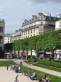
Charenton-le-Pont is a commune in the southeastern suburbs of Paris, France. It is located 6.2 km (3.9 mi) from the centre of Paris. It is one of the most densely populated municipalities in Europe.
Contents
- Map of 94220 Charenton le Pont France
- History
- Transport
- Education
- Twin towns Sister cities
- Economy
- References
Map of 94220 Charenton-le-Pont, France
The Charenton Psychiatric Hospital is located in the neighbouring commune Charenton-Saint-Maurice, which changed its name in 1842 to Saint Maurice.
History
A Bronze Age hoard of weapons was found in the river Seine at Charenton in the late nineteenth century. Comprising swords, axes, spear heads and other miscellaneous objects, it is now in the British Museum.
On 1 January 1860, the city of Paris was enlarged by annexing neighbouring communes. On that occasion, half of the commune of Bercy was annexed to the city of the Paris, and the remaining half was annexed to Charenton-le-Pont.
In 1929, the commune of Charenton-le-Pont lost about a third of its territory when the city of Paris annexed the Bois de Vincennes, a small part of which belonged to Charenton-le-Pont.
Transport
Charenton-le-Pont is served by two stations on Paris Métro Line 8: Liberté and Charenton — Écoles.
Education
As of 2015 the commune has 14 public and private schools.
Twin towns – Sister cities
Charenton-le-Pont is twinned with: