Harman Patil (Editor)

Charenton du Cher

Updated on
Edit
Like
Comment
Share on FacebookTweet on TwitterShare on LinkedInShare on Reddit
Country
  
France

Department
  
Cher

Intercommunality
  
Berry charentonnais

Area
  
47.89 km²

Arrondissement
  
Saint-Amand-Montrond

Region
  
Centre-Val de Loire

Canton
  
Charenton-du-Cher

Population (2008)
  
1,119

Local time
  
Friday 5:43 AM

Charenton-du-Cher mw2googlecommwpanoramiophotosmedium51038095jpg

Weather
  
7°C, Wind E at 11 km/h, 80% Humidity

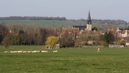
Charenton-du-Cher is a commune in the Cher department in the Centre region of France.

Contents

Map of Charenton-du-Cher, France

Geography

An area of farming, forestry and a little light industry comprising the village and several hamlets situated by the banks of both the canal de Berry and the river Marmande, some 28 miles (45 km) southeast of Bourges at the junction of the D951 with the D1 and D953 roads.

Sights

  • The church of St. Martin, dating from the eleventh century.
  • The motte of a tenth-century castle (30m diameter, 10m high).
  • A fifteenth-century house on the rue Blanche.
  • An old forge and its associated buildings, La "Grosse Forge"
  • Remains of the convent abbey of Notre-Dame de Bellevaux, founded in 620.
  • The remains of the 15th century chapel of St. Julien.
  • A public washhouse.
  • References

    Charenton-du-Cher Wikipedia


    Similar Topics