
Country Brazil | Area 6,207 km² | |
 | ||
Time zone BRT-1/BRST-1 (UTC-4/-3) | ||
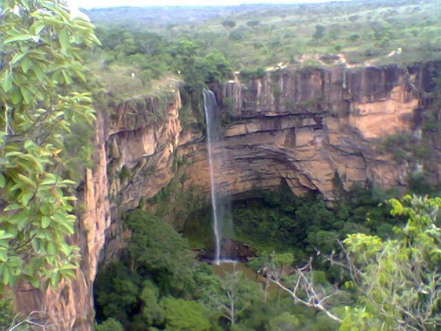
Chapada dos Guimarães is a municipality located in central Brazil, 62 km from the city of Cuiaba, the capital of Mato Grosso State. It is home to the Chapada dos Guimarães National Park. Outside this town is the geographic center of South America.
Contents
- Map of Chapada dos GuimarC3A3es State of Mato Grosso Brazil
- Parque nacional da chapada dos guimar es mato grosso brazil june 8th 2014
- References
Map of Chapada dos Guimar%C3%A3es - State of Mato Grosso, Brazil
The municipality contains 77% of the 3,534 hectares (8,730 acres) Rio da Casca Ecological Station, a strictly protected conservation unit created in 1994. The municipal seat contains the 31 hectares (77 acres) Quineira State Park, created in 2006.
Parque nacional da chapada dos guimar es mato grosso brazil june 8th 2014
References
Chapada dos Guimarães Wikipedia(Text) CC BY-SA