
Area 396.1 km² | ||
 | ||
Administrative divisions 1 ŭp, 1 rodongjagu, 19 ri | ||
Changyŏn County is a county in South Hwanghae province, North Korea.
Contents
- Map of Changyon South Hwanghae North Korea
- Geography
- History
- Transportation
- Administrative Divisions
- People born in Changyn
- References
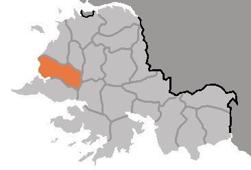
Map of Changyon, South Hwanghae, North Korea
Geography
Changyŏn is bordered to the north by Kwail and Songhwa, to the east by Samch'ŏn and T'aet'an, to the south by Ryongyŏn, and to the west by the Yellow Sea. Most of the land in Changyŏn is composed of flat plains, with mountains forming its borders. The highest point is Mt. Pult'a, at 609 meters (1,998 ft).
History
Changyŏn county was created under the Yi dynasty. Chaeryŏng was briefly merged into the newly formed Hwanghae District in 1895 during an experimental redistricting, but was restored to its previous form in 1896. The county's current form was settled in the 1952 redistricting changes, when the entire south of the county was split away to form Ryongyŏn county. In 1956 it became part of South Hwanghae Province when the former Hwanghae Province was split.
Transportation
The county is served by the Changyŏn Line of the Korean State Railway, which stops at Ragyŏn and Changyŏn stations. There is also a highway which runs through Changyŏn-ŭp.
Administrative Divisions
The county is divided into one town (ŭp), 1 Worker's District (rodongjagu) and 19 villages (ri).