
Area 605.2 km² | Region North P'yŏngan Local time Friday 5:51 AM | |
 | ||
Administrative divisions 1 ŭp, 1 workers' districts, 15 ri Weather -6°C, Wind SE at 10 km/h, 79% Humidity | ||
Ch'angsŏng County is a kun, or county, in northern North P'yŏngan province, North Korea. It is bordered by Pyŏktong to the east, Tongch'ang and Taegwan to the south, Sakchu to the west; to the north, it faces China across the Yalu (Amrok) River.
Contents
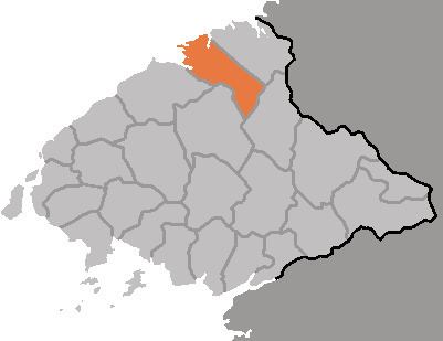
- Map of Changsong North Pyongan North Korea
- Geography
- Administrative Divisions
- Climate
- Economy
- Transportation
- References
Map of Changsong, North Pyongan, North Korea
Geography
Ch'angsŏng's terrain is steep and mountainous, sloping generally downward from the southeast toward the Yalu. The Kangnam Mountains and Pandŏk Mountains both pass through the county. The highest point is Piraebong, at 1470 m. The county is drained by various tributaries of the Yalu, including the Yŏngjuch'ŏn (영주천) and Namch'angch'ŏn (남창천), as well as by the Ch'angsŏng River, a tributary of the Taeryŏng. The Yalu itself has been blocked by the Sup'ung Dam to create Sup'ung Lake.
Administrative Divisions
Ch'angsŏng county is divided into 1 ŭp (town). 1 rodongjagu (workers' district) and 15 ri (villages):
Climate
Annual rainfall in Ch'angsŏng is 1000 mm, with an annual average temperature of 7.3 °C (the average fluctuating from -11.6 °C in January to 22 °C in August). Temperatures are of course much colder in the mountains, with the snows atop Piraebong not melting until late May. Fog is common near Sup'ung Lake. Some 80% of the county's land is forested, while only 6.1% is under cultivation.
Economy
Sericulture is widely practised; other crops include maize, rice, peanuts, gochu peppers, sweet potatoes, and various fruits. Ch'angsŏng also leads the county in the production of sheep. Various products, including lumber and medicinal herbs, are harvested from the forests. In addition, gold, tungsten, and coal are mined from the hills. Local manufactured products include gochujang and alcohol.
Transportation
There are no railroads, but a road does connect Ch'angsŏng to Sakchu, Tongch'ang, and Pyŏktong. Freight and passenger traffic is also carried by ships plying Lake Sup'ung; the lake is also used to transport raw lumber.