
Country India District Champawat Vehicle registration UK-03 Elevation 1,610 m Local time Thursday 6:07 AM | Time zone IST (UTC+5:30) Website uk.gov.in Population 35,000 (2001) | |
 | ||
Weather 6°C, Wind N at 5 km/h, 100% Humidity | ||
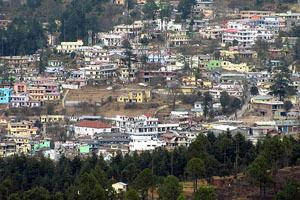
View of lohaghat town of champawat district uttarakhand
Champawat (Hindi: चम्पावत) is a town and a Nagar Palika Parishad in Champawat district in the state of Uttarakhand, India. It is the administrative headquarters of Champawat district.
Contents
- View of lohaghat town of champawat district uttarakhand
- Map of Champawat Uttarakhand 262523
- Roadside vendors in lohaghat champawat uttarakhand
- Mythology
- History
- Shani Mandir
- Geography
- Demographics
- References
Map of Champawat, Uttarakhand 262523
Roadside vendors in lohaghat champawat uttarakhand
Mythology
Champawat is believed to the place where the Kurmavtar (the turtle incarnation of Lord Vishnu) took place.at days there is a temple which is called kranteshwar mandir who dedicated lord shiva
History
Champawat was formerly the capital of the Chand dynasty rulers. The Baleshwar Temple built by the Chand rulers in the 12th century is an excellent monument with marvelous stone carving works.
Shani Mandir
In Maurari (Banlekh) Village is a Famous Temple, Shaani Mandir (Manokamna Purn Mandir Kaula ). It Temple is near to Champawat, 10 km south from Main Market Champawat.
Geography
Champawat is located at 29.33°N 80.10°E / 29.33; 80.10. It has an average elevation of 1,610 metres (5,280 feet).
Demographics
As of 2001 India census, Champawat had a population of 3958. Males constitute 57% of the population and females 43%. Champawat has an average literacy rate of 73%, higher than the national average of 59.5%; with male literacy of 78% and female literacy of 67%. 14% of the population is under 6 years of age.