
Country Pakistan Time zone PKT (UTC+5) | Area 6,524 km² | |
 | ||
Tehsils (5) ListChakwalKallar KaharChoa Saidan ShahTalagangLawa | ||
Chakwal District (Urdu: ضِلع چکوال) is in Pothohar Plateau of Punjab, Pakistan. It is located in the north of the Punjab province, Chakwal district is bordered by Khushab to its south, Rawalpindi to its north east, Jhelum to its east, Mianwali to its west and Attock to its north west. The district was created out of pats of Jhelum and Attock in 1985. The large part of M2 passes through Chakwal District.
Contents
- Map of Chakwal Pakistan
- Administrative divisions
- Constituencies
- Geography
- History
- Demography
- Education
- Educational institutions
- Notables
- References
Map of Chakwal, Pakistan
The Best Way Cement Factory, the largest factory in Asia is located in District Chakwal. Currently, Chakwal is noted for the production of international standard oranges, wheat, barley, sugarcane, and many other fruits and vegetables. Chakwal has an urban population of 12%; the remainder is rural. That makes Chakwal, the district with largest rural population in Punjab, Pakistan.
Administrative divisions
The district of Chakwal, which covers an area of 6,524 km², is subdivided into five tehsils. These tehsils were formerly part of neighbouring districts:
The district is administratively subdivided into five tehsils and 68 Union Councils.
Constituencies
There is one district council, two municipal committees — Chakwal and Talagang — and two town committees — Choa Saidan Shah and Kallar Kahar.
The district is represented in the National Assembly by two constituencies: NA-60 and NA-61. The district is represented in the provincial assembly by four elected MPAs and in National Assembly by two MNAs who represent the following constituencies:
Geography
Chakwal district borders the districts of Rawalpindi and Attock in the north, Jhelum in the east, Khushab in the south and Mianwali in the west. The total area of Chakwal district is 6,609 square kilometres, which is equivalent to 1,652,443 acres (6,687.20 km2).
The southern portion runs up into the Salt Range, and includes the Chail peak, 3,701 feet (1,128 m) above the sea, the highest point in the district. Between this and the Sohan river, which follows more or less the northern boundary, the country consists of what was once a fairly level plain, sloping down from 2,000 feet (610 m) at the foot of the hills to 1,400 feet (430 m) in the neighbourhood of the Sohan; the surface is now much cut up by ravines and is very difficult to travel over.
Lying at the beginning of the Potohar plateau and the Salt Range, Chakwal is a barani district and the terrain is mainly hilly, covered with scrub forest in the southwest and leveled plains interspaced with dry rocky patches in the north and northeast.
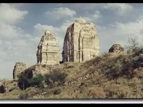
History
In 997 CE, Sultan Mahmud Ghaznavi, took over the Ghaznavid dynasty empire established by his father, Sultan Sebuktegin. In 1005 he conquered the Shahis in Kabul in 1005, and followed it by the conquests of Punjab region. The Delhi Sultanate and later Mughal Empire ruled the region. The Punjab region became predominantly Muslim due to missionary Sufi saints whose dargahs dot the landscape of Punjab region. After the decline of the Mughal Empire, the Sikh Empire invaded and occupied Mianwali District. The Muslims faced restrictions during the Sikh rule.
During British rule, Chakwal was a tehsil of Jhelum district, the population according to the 1891 census of India was 164,912 which had fallen to 160,316 in 1901. It contained the towns of Chakwal and Bhaun and 248 villages. The land revenue and cesses amounted in 1903-4 to 3–300,000. The predominantly Muslim population supported Muslim League and Pakistan Movement. After the independence of Pakistan in 1947, the minority Hindus and Sikhs migrated to India while the Muslims refugees from India settled down in the Chakwal District.
The boundaries and area of the tehsil were described by the Imperial Gazetteer of India as follows the tehsil "lies between 28° 45' and 30°05' N. and 72°32' and 73° 13' E., with an area of 1,004 square miles".
Demography
According to the 1998 census of Pakistan, the total population is 1,083,725 of which only 12.01% were urban — making Chakwal the most rural district in Punjab. The literacy rate in 1998 was 57%.
The predominantly Muslim population supported Muslim League and Pakistan Movement. After the independence of Pakistan in 1947, the minority Hindus and Sikhs migrated to India while the Muslim refugees from India settled in the Chakwal District.
According to the 1998 census, the predominant first language of the district is Punjabi, spoken by 97.7% of the population. Pashto is the first language of 1.2%, and Urdu – of 0.9%. The local Punjabi dialects are Dhani and Awankari
Education
Chakwal has a total of 1,199 government schools out of which 52 percent (627 schools) are for girl students. The district has an enrolment of 181,574 in public sector schools.