
Elevation 1,896 m | Prominence 465 m | |
 | ||
Similar Wageten, Bockmattli, Schiberg, Mutteristock, Brünnelistock | ||
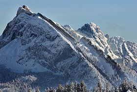
The Chöpfenberg (1,896 m) is a mountain of the Schwyzer Alps, located on the border between the Swiss cantons of Schwyz and Glarus. It lies on the range north of the Mutteristock, between the valleys of the Wägitalersee and the Linth.
Map of Ch%C3%B6pfenberg, 8867 Niederurnen, Switzerland
References
Chöpfenberg Wikipedia(Text) CC BY-SA