
Main source Soudan80 m (260 ft) Basin size 390 km (150 sq mi) Basin area 390 km² | River mouth Vilaine3 m (9.8 ft) Length 65 km | |
 | ||
Discharge Average rate:2.4 m/s (85 cu ft/s) | ||
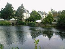
The Chère (French: la Chère) is a 65.1 km (40.5 mi) long river in the Loire-Atlantique and Ille-et-Vilaine départements, western France. Its source is at Soudan. It flows generally west. It is a left tributary of the Vilaine into which it flows between Pierric and Sainte-Anne-sur-Vilaine.
Contents
Map of La Ch%C3%A8re, Sion-les-Mines, France
Communes along its course
This list is ordered from source to mouth:
References
Chère Wikipedia(Text) CC BY-SA