Puneet Varma (Editor)

Châteauneuf sur Cher

Updated on
Edit
Like
Comment
Share on FacebookTweet on TwitterShare on LinkedInShare on Reddit
Country
  
France

Department
  
Cher

Intercommunality
  
Rives du Cher

Area
  
21.97 km²

Arrondissement
  
Saint-Amand-Montrond

Region
  
Centre-Val de Loire

Canton
  
Châteauneuf-sur-Cher

Population (2008)
  
1,537

Local time
  
Friday 5:09 PM

Châteauneuf-sur-Cher

Weather
  
17°C, Wind SE at 16 km/h, 54% Humidity

Châteauneuf-sur-Cher is a commune in the Cher department in the Centre region of France.

Contents

Map of 18190 Ch%C3%A2teauneuf-sur-Cher, France

Geography

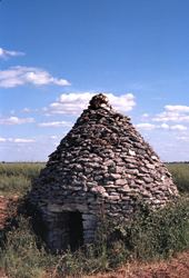
An area of farming and forestry comprising a large village and several hamlets situated in the valley of the river Cher, some 16 miles (26 km) south of Bourges at the junction of the D940 with the D73, D35 and the D14 roads.

Sights

  • The nineteenth-century church of Notre-Dame.
  • A thirteenth-century castle.
  • The twelfth-century church at the hamlet of Marigny.
  • The winegrowers’ stone cabin at Marigny.
  • Personalities

  • Ernest-Francois Mallard (1833–1894), mineralogist was born here.
  • References

    Châteauneuf-sur-Cher Wikipedia