
Time zone CET (UTC+1) Area 42.48 km² Local time Friday 5:07 PM | INSEE/Postal code 18057 / 18370 Population 2,058 (1999) | |
 | ||
Weather 16°C, Wind S at 23 km/h, 57% Humidity | ||
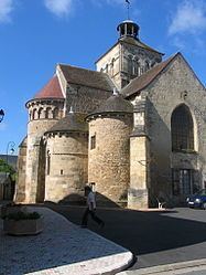
Châteaumeillant is a commune in the Cher department in the Centre region of France.
Contents
Map of 18370 Ch%C3%A2teaumeillant, France
Geography
An area of winegrowing, farming and forestry comprising a small town and several hamlets situated in the valley of the small river Sinaise, some 40 miles (64 km) south of Bourges at the junction of the D943 with the D3 and the D70 roads.
Sights
References
Châteaumeillant Wikipedia(Text) CC BY-SA