
Country United States FIPS code 19-12630 Elevation 346 m Zip code 52068 Population 130 (2013) | Time zone Central (CST) (UTC-6) GNIS feature ID 0455332 Area 150 ha Local time Tuesday 7:20 PM Area code 563 | |
 | ||
Weather 5°C, Wind SW at 21 km/h, 54% Humidity | ||
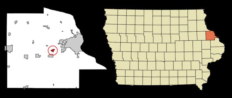
Centralia is a city in Dubuque County, Iowa, United States. It is part of the Dubuque, Iowa Metropolitan Statistical Area. The population was 134 at the 2010 census, up from 101 at the 2000 census.
Contents
Map of Centralia, IA 52068, USA
History
Centralia was laid out about 1850.
Geography
Centralia is located at 42°28′20″N 90°50′10″W (42.472258, -90.836042).
According to the United States Census Bureau, the city has a total area of 0.58 square miles (1.50 km2), all of it land.
2010 census
As of the census of 2010, there were 134 people, 52 households, and 39 families residing in the city. The population density was 231.0 inhabitants per square mile (89.2/km2). There were 54 housing units at an average density of 93.1 per square mile (35.9/km2). The racial makeup of the city was 98.5% White and 1.5% from two or more races.
There were 52 households of which 34.6% had children under the age of 18 living with them, 55.8% were married couples living together, 15.4% had a female householder with no husband present, 3.8% had a male householder with no wife present, and 25.0% were non-families. 19.2% of all households were made up of individuals and 1.9% had someone living alone who was 65 years of age or older. The average household size was 2.58 and the average family size was 2.87.
The median age in the city was 39.5 years. 20.9% of residents were under the age of 18; 7.4% were between the ages of 18 and 24; 28.4% were from 25 to 44; 33.6% were from 45 to 64; and 9.7% were 65 years of age or older. The gender makeup of the city was 50.0% male and 50.0% female.
2000 census
As of the census of 2000, there were 101 people, 38 households, and 28 families residing in the city. The population density was 183.9 people per square mile (70.9/km²). There were 40 housing units at an average density of 72.8 per square mile (28.1/km²). The racial makeup of the city was 99.01% White and 0.99% Native American.
There were 38 households out of which 39.5% had children under the age of 18 living with them, 71.1% were married couples living together, 2.6% had a female householder with no husband present, and 26.3% were non-families. 15.8% of all households were made up of individuals and 7.9% had someone living alone who was 65 years of age or older. The average household size was 2.66 and the average family size was 3.00.
In the city, the population was spread out with 30.7% under the age of 18, 4.0% from 18 to 24, 35.6% from 25 to 44, 19.8% from 45 to 64, and 9.9% who were 65 years of age or older. The median age was 32 years. For every 100 females there were 114.9 males. For every 100 females age 18 and over, there were 94.4 males.
The median income for a household in the city was $43,333, and the median income for a family was $52,917. Males had a median income of $40,833 versus $18,125 for females. The per capita income for the city was $15,269. There were 6.5% of families and 13.8% of the population living below the poverty line, including 24.4% of under eighteens and 22.2% of those over 64.