
Population 2,088 (2015 est) Website Central Darling Shire Area 53,511 km² Region Far West | Council seat Wilcannia | |
 | ||
Mayor Raymond Longfellow (Unaligned) | ||
Central Darling Shire is a local government area in the Far West region of New South Wales, Australia. The Shire is located adjacent to the Barrier Highway. Central Darling Shire was constituted in 1959 and at 53,511 square kilometres (20,661 sq mi), it is the largest local government area in New South Wales.
Contents
- Map of Central Darling NSW Australia
- Main townsvillages
- Incomes
- Current composition and election method
- Economic activity
- References
Map of Central Darling, NSW, Australia
The Mayor of Central Darling Shire Council is Cr. Ray Longfellow, who is unaligned with any political party.
Main towns/villages
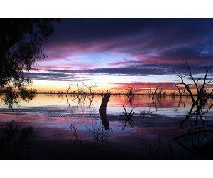
The Shire includes the towns of Ivanhoe, Menindee, Wilcannia and White Cliffs.
Incomes
According to the Australian Bureau of Statistics during 2003-04 there:
Current composition and election method
Central Darling Shire Council is composed of nine Councillors elected proportionally as three separate wards, each electing three Councillors. All Councillors are elected for a fixed four-year term of office. The Mayor is elected by the Councillors at the first meeting of the Council. The most recent election was held on 8 September 2012, and the makeup of the Council is as follows:
The current Council, elected in 2012, in order of election by ward, is:
Economic activity
The principle economic activities within the Shire include pastoral, horticultural, agricultural, mining and tourism. Rural grazing properties represent the largest land use within the Shire, accounting for 97% of the entire area. Major horticultural and agricultural production is centred on Menindee. The relative ease of access to water from the Darling River and Menindee Lakes Storage Scheme enables producers to grow a large variety of crops and fruits.
Opal mining has been the predominant mining industry within the Shire. Opal was discovered in White Cliffs in 1884 and the first commercial opal field commenced operation in 1890, reaching its peak in 1899.