
 | ||
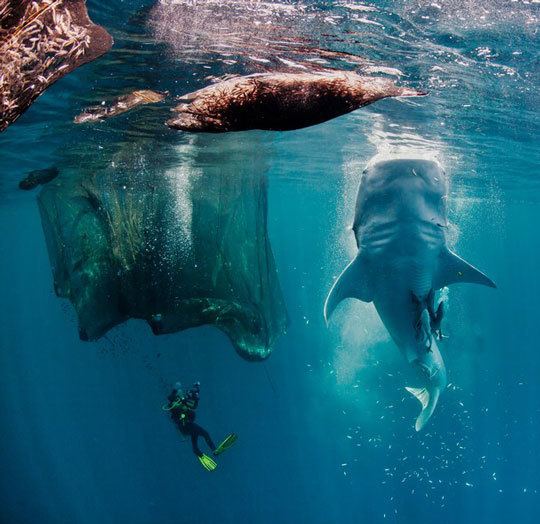
Best scuba diving with whale sharks underwater video cenderawasih bay indonesia hd
Cenderawasih Bay (Indonesian: Teluk Cenderawasih, means : Bird of Paradise Bay), also Teluk Sarera (Sarera Bay), formerly Geelvink Bay (Dutch: Geelvinkbaai) is a large bay in northern Province of Papua and West Papua, New Guinea, Indonesia, at 2.5°S 135.3°E / -2.5; 135.3. The Dutch name comes from a Dutch ship and family called Geelvinck. The western part of the bay was declared a marine national park in 2002.
Contents
- Best scuba diving with whale sharks underwater video cenderawasih bay indonesia hd
- Map of Cenderawasih Bay Indonesia
- Dive damai live aboard indonesia at cenderawasih bay
- Islands
- References
Map of Cenderawasih Bay, Indonesia
Teluk Cenderawasih National Park is located in the Teluk Cenderawasih.
Dive damai live aboard indonesia at cenderawasih bay
Islands
West Papua Province:
Papua Province:
The Wamma River, Tabai River, Warenai River, and Wapoga River empty into the Bay.
The Mapia Islands lie to the north, and south of Palau. Bird's Head Peninsula borders the northwest part of the Bay.
References
Cenderawasih Bay Wikipedia(Text) CC BY-SA