
Length 3.6 mi (5.8 km) Major cities Huntsville | Location Huntsville, Alabama | |
 | ||
East end Old Big Cove Roadcontinues as Sutton Road West end Carl T. Jones DriveBailey Cove Roadcontinues as Four Mile Post Road | ||
Concrete repair on cecil ashburn drive road in huntsville al
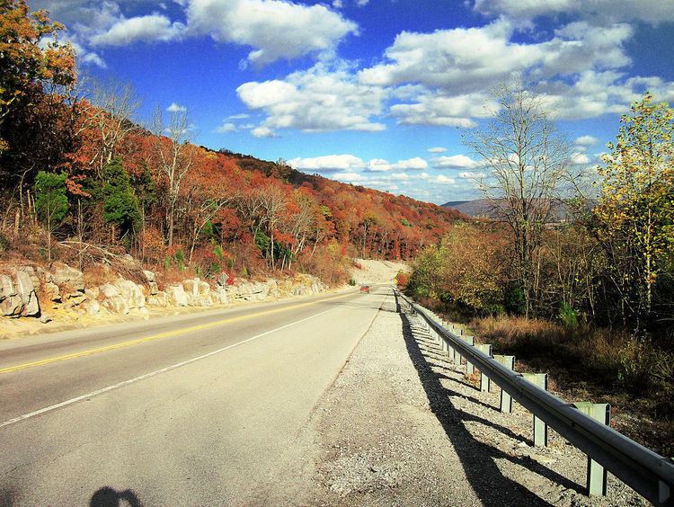
Cecil Ashburn Drive is a major road in South Huntsville that carries nearly 20,000 vehicles across Huntsville Mountain in and out of the city from neighboring subdivisions. The scenic mountain route is only two lanes wide with wide shoulders to allow joggers and bicyclists to safely travel the road.
Contents
- Concrete repair on cecil ashburn drive road in huntsville al
- Traveling cecil ashburn drive in huntsville
- Road description
- History
- Safety
- References
Traveling cecil ashburn drive in huntsville
Road description
Cecil Ashburn Drive is a part of a line of roads that connect Whitesburg Drive in Southeast Huntsville to U.S. Highway 72 in Gurley.
From the west, the road starts as Four Mile Post Road running through a dense residential neighborhood and runs pass Jones Family Park, Atwood Linear Park Greenway, and Valley Bend At Jones Farm. Upon intersecting Carl T. Jones Drive and Bailey Cove Road, the road takes on the name Cecil Ashburn Drive where it widens to five lanes (one of those being the center turn lane) and travels through a strip building retail area until almost the base of the mountain. As it starts up the mountain, the road narrows to two lanes. The road twists along the mountain with limited access; only two intersections occur while traveling across the mountain: Avalon Drive and one parking lot for hikers. The road travels through the Blevins Gap Nature Preserve and provides trail heads for numerous hiking trails.
Once on the east side of the mountain, the road intersects Old Big Cove Road and becomes Sutton Road. After a short stretch, the road widens back to four lanes and intersects Taylor Road followed by U.S. Highway 431 where the road takes on the name Old Highway 431. This portion is a part of the future Bypass Network for the city of Huntsville and is also known as the Eastern Bypass as it travels through Hampton Cove and the Robert Trent Jones Golf Trail. The road eventuality narrows to two lanes and a turn lane and becomes Little Cove Road and connects to U.S. Highway 72.
History
The road was built in the late 1990s and opened to traffic in January 2000 as a quick way for the fast-growing Hampton Cove subdivision to access Huntsville. The City of Huntsville named the road after James Cecil Ashburn in January 2002.
Safety
The safety of the road has been called in to question following a few deadly wrecks. Most wrecks generally occur along same stretch of road and are similar in details: A car traveling west into the city loses control while traveling around a curve near Avalon Drive. The wrecks sometimes occur after rain and the vehicle generally hits another vehicle head on. The reality is that the road is never the cause of the accidents - it has always been driver error, usually caused by distracted driving. As noted, over 20,000 cars travel this road daily and the incidents of wrecks that have happened in almost 15 years have been minimal. Unlike other roads in the area (for example Hwy 72 over Chapman Mountain) which are straight, with long-distance visibility, but have an inordinate amount of wrecks, Cecil Ashburn has a very good safety record.
Since the road opened a total of four people have been killed on the road and nine people have been seriously injured. In June 2012, one person died and four others where injured in a wreck near Avalon Drive, the same location where two young women where killed in December 2011. More recently, on September 28, 2014, another person died in a wreck which also injured four others. This most recent wreck happened on the straightest part of the road, during a dry, sunny day. One driver simply crossed the yellow line and hit another vehicle head on with no warning. The cause was driver error.