
Population 726 (2011 census) Cawarral Coorooman | Postcode(s) 4702 Postal code 4702 | |
 | ||
Location 24.1 km (15 mi) SW of Yeppoon28.4 km (18 mi) NE of Rockhampton644 km (400 mi) NNW of Brisbane | ||
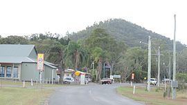
Cawarral is a town and locality in the Shire of Livingstone, Queensland, Australia. In the 2011 census, Cawarral had a population of 726 people.
Contents
Map of Cawarral QLD 4702, Australia
History
Cawarral State School opened on 13 July 1874.
Education
Cawaral State School is a government co-educational primary (P-6) school at 125 Annie Drive. In 2015, Cawarral State School had an enrolment of 87 students with 6 teachers (5 full-time equivalent).
Facilities
The Cawarral Cemetery is on the corner of Cemetery Road and Helena Lane (23.2630°S 150.6645°E / -23.2630; 150.6645 (Cawarral Cemetery)) and is managed by the Livingstone Shire Council.
References
Cawarral Wikipedia(Text) CC BY-SA