
 | ||
The causes of landslides are usually related to instabilities in slopes. It is usually possible to identify one or more landslide causes and one landslide trigger. The difference between these two concepts is subtle but important. The landslide causes are the reasons that a landslide occurred in that location and at that time. Landslide causes are listed in the following table, and include geological factors, morphological factors, physical factors and factors associated with human activity.
Contents
- Geological causes
- Morphological causes
- Physical causes
- Human causes
- Summary
- Snowmelt
- Water level change
- Rivers
- Seismicity
- Seismic shaking
- Liquefaction
- The nature of seismically triggered landslides
- Volcanic activity
- References
Causes may be considered to be factors that made the slope vulnerable to failure, that predispose the slope to becoming unstable. The trigger is the single event that finally initiated the landslide. Thus, causes combine to make a slope vulnerable to failure, and the trigger finally initiates the movement. Landslides can have many causes but can only have one trigger as shown in the next figure. Usually, it is relatively easy to determine the trigger after the landslide has occurred (although it is generally very difficult to determine the exact nature of landslide triggers ahead of a movement event).
Occasionally, even after detailed investigations, no trigger can be determined - this was the case in the large Mount Cook landslide in New Zealand 1991. It is unclear as to whether the lack of a trigger in such cases is the result of some unknown process acting within the landslide, or whether there was in fact a trigger, but it cannot be determined. Perhaps this is because the trigger was in fact a slow but steady decrease in material strength associated with the weathering of the rock - at some point the material becomes so weak that failure must occur. Hence the trigger is the weathering process, but this is not detectable externally. In most cases we think of a trigger as an external stimulus that induces an immediate or near-immediate response in the slope, in this case in the form of the movement of the landslide. Generally this movement is induced either because the stresses in the slope are altered, perhaps by increasing shear stress or decreasing the effective normal stress, or by reducing the resistance to the movement perhaps by decreasing the shear strength of the materials within the landslide.
Geological causes
Morphological causes
Physical causes
Topography
Geological Factors
Tectonic Activity
Physical Weathering
Hydrogeological Factors
Human causes
Summary
In the majority of cases the main trigger of landslides is heavy or prolonged rainfall. Generally this takes the form of either an exceptional short lived event, such as the passage of a tropical cyclone or even the rainfall associated with a particularly intense thunderstorm or of a long duration rainfall event with lower intensity, such as the cumulative effect of monsoon rainfall in South Asia. In the former case it is usually necessary to have very high rainfall intensities, whereas in the latter the intensity of rainfall may be only moderate - it is the duration and existing pore water pressure conditions that are important. The importance of rainfall as a trigger for landslides cannot be underestimated. A global survey of landslide occurrence in the 12 months to the end of September 2003 revealed that there were 210 damaging landslide events worldwide. Of these, over 90% were triggered by heavy rainfall. One rainfall event for example in Sri Lanka in May 2003 triggered hundreds of landslides, killing 266 people and rendering over 300,000 people temporarily homeless. In July 2003 an intense rain band associated with the annual Asian monsoon tracked across central Nepal, triggering 14 fatal landslides that killed 85 people. The reinsurance company Swiss Re estimated that rainfall induced landslides associated with the 1997-1998 El Nino event triggered landslides along the west coast of North, Central and South America that resulted in over $5 billion in losses. Finally, landslides triggered by Hurricane Mitch in 1998 killed an estimated 18,000 people in Honduras, Nicaragua, Guatemala and El Salvador. So why does rainfall trigger so many landslides? Principally this is because the rainfall drives an increase in pore water pressures within the soil. The Figure A illustrates the forces acting on an unstable block on a slope. Movement is driven by shear stress, which is generated by the mass of the block acting under gravity down the slope. Resistance to movement is the result of the normal load. When the slope fills with water, the fluid pressure provides the block with buoyancy, reducing the resistance to movement. In addition, in some cases fluid pressures can act down the slope as a result of groundwater flow to provide a hydraulic push to the landslide that further decreases the stability. Whilst the example given in Figures A and B is clearly an artificial situation, the mechanics are essentially as per a real landslide.
In some situations, the presence of high levels of fluid may destabilise the slope through other mechanisms, such as:
• Fluidization of debris from earlier events to form debris flows;
• Loss of suction forces in silty materials, leading to generally shallow failures (this may be an important mechanism in residual soils in tropical areas following deforestation);
• Undercutting of the toe of the slope through river erosion.
Considerable efforts have been made to understand the triggers for landsliding in natural systems, with quite variable results. For example, working in Puerto Rico, Larsen and Simon found that storms with a total precipitation of 100–200 mm, about 14 mm of rain per hour for several hours, or 2–3 mm of rain per hour for about 100 hours can trigger landslides in that environment. Rafi Ahmad, working in Jamaica, found that for rainfall of short duration (about 1 hour) intensities of greater than 36 mm/h were required to trigger landslides. On the other hand, for long rainfall durations, low average intensities of about 3 mm/h appeared to be sufficient to cause landsliding as the storm duration approached approximately 100 hours. Corominas and Moya (1999) found that the following thresholds exist for the upper basin of the Llobregat River, Eastern Pyrenees area. Without antecedent rainfall, high intensity and short duration rains triggered debris flows and shallow slides developed in colluvium and weathered rocks. A rainfall threshold of around 190 mm in 24 h initiated failures whereas more than 300 mm in 24-48 h were needed to cause widespread shallow landsliding. With antecedent rain, moderate intensity precipitation of at least 40 mm in 24 h reactivated mudslides and both rotational and translational slides affecting clayey and silty-clayey formations. In this case, several weeks and 200 mm of precipitation were needed to cause landslide reactivation. A similar approach is reported by Brand et al. (1988) for Hong Kong, who found that if the 24-hour antecedent rainfall exceeded 200 mm then the rainfall threshold for a large landslide event was 70 mm·h−1. Finally, Caine (1980) established a worldwide threshold:
I = 14.82 D - 0.39 where: I is the rainfall intensity (mm·h−1), D is duration of rainfall (h)
This threshold applies over time periods of 10 minutes to 10 days. It is possible to modify the formula to take into consideration areas with high mean annual precipitations by considering the proportion of mean annual precipitation represented by any individual event. Other techniques can be used to try to understand rainfall triggers, including:
• Actual rainfall techniques, in which measurements of rainfall are adjusted for potential evapotranspiration and then correlated with landslide movement events
• Hydrogeological balance approaches, in which pore water pressure response to rainfall is used to understand the conditions under which failures are initiated
• Coupled rainfall - stability analysis methods, in which pore water pressure response models are coupled to slope stability models to try to understand the complexity of the system
• Numerical slope modelling, in which finite element (or similar) models are used to try to understand the interactions of all relevant processes
Snowmelt
In many cold mountain areas, snowmelt can be a key mechanism by which landslide initiation can occur. This can be especially significant when sudden increases in temperature lead to rapid melting of the snow pack. This water can then infiltrate into the ground, which may have impermeable layers below the surface due to still-frozen soil or rock, leading to rapid increases in pore water pressure, and resultant landslide activity. This effect can be especially serious when the warmer weather is accompanied by precipitation, which both adds to the groundwater and accelerates the rate of thawing.
Water-level change
Rapid changes in the groundwater level along a slope can also trigger landslides. This is often the case where a slope is adjacent to a water body or a river. When the water level adjacent to the slope falls rapidly the groundwater level frequently cannot dissipate quickly enough, leaving an artificially high water table. This subjects the slope to higher than normal shear stresses, leading to potential instability. This is probably the most important mechanism by which river bank materials fail, being significant after a flood as the river level is declining (i.e. on the falling limb of the hydrograph) as shown in the following figures.
It can also be significant in coastal areas when sea level falls after a storm tide, or when the water level of a reservoir or even a natural lake rapidly falls. The most famous example of this is the Vajont failure, when a rapid decline in lake level contributed to the occurrence of a landslide that killed over 2000 people.
Rivers
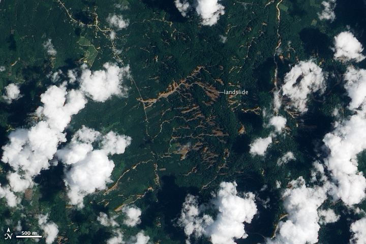
In some cases, failures are triggered as a result of undercutting of the slope by a river, especially during a flood. This undercutting serves both to increase the gradient of the slope, reducing stability, and to remove toe weighting, which also decreases stability. For example, in Nepal this process is often seen after a glacial lake outburst flood, when toe erosion occurs along the channel. Immediately after the passage of flood waves extensive landsliding often occurs. This instability can continue to occur for a long time afterwards, especially during subsequent periods of heavy rain and flood events.
Seismicity
The second major factor in the triggering of landslides is seismicity. Landslides occur during earthquakes as a result of two separate but interconnected processes: seismic shaking and pore water pressure generation.
Seismic shaking
The passage of the earthquake waves through the rock and soil produces a complex set of accelerations that effectively act to change the gravitational load on the slope. So, for example, vertical accelerations successively increase and decrease the normal load acting on the slope. Similarly, horizontal accelerations induce a shearing force due to the inertia of the landslide mass during the accelerations. These processes are complex, but can be sufficient to induce failure of the slope. These processes can be much more serious in mountainous areas in which the seismic waves interact with the terrain to produce increases in the magnitude of the ground accelerations. This process is termed 'topographic amplification'. The maximum acceleration is usually seen at the crest of the slope or along the ridge line, meaning that it is a characteristic of seismically triggered landslides that they extend to the top of the slope.
Liquefaction
The passage of the earthquake waves through a granular material such as a soil can induce a process termed liquefaction, in which the shaking causes a reduction in the pore space of the material. This densification drives up the pore pressure in the material. In some cases this can change a granular material into what is effectively a liquid, generating 'flow slides' that can be rapid and thus very damaging. Alternatively, the increase in pore pressure can reduce the normal stress in the slope, allowing the activation of translational and rotational failures.
The nature of seismically-triggered landslides
For the main part seismically generated landslides usually do not differ in their morphology and internal processes from those generated under non-seismic conditions. However, they tend to be more widespread and sudden. The most abundant types of earthquake-induced landslides are rock falls and slides of rock fragments that form on steep slopes. However, almost every other type of landslide is possible, including highly disaggregated and fast-moving falls; more coherent and slower-moving slumps, block slides, and earth slides; and lateral spreads and flows that involve partly to completely liquefied material (Keefer, 1999). Rock falls, disrupted rock slides, and disrupted slides of earth and debris are the most abundant types of earthquake-induced landslides, whereas earth flows, debris flows, and avalanches of rock, earth, or debris typically transport material the farthest. There is one type of landslide that is essential uniquely limited to earthquakes - liquefaction failure, which can cause fissuring or subsidence of the ground. Liquefaction involves the temporary loss of strength of sands and silts which behave as viscous fluids rather than as soils. This can have devastating effects during large earthquakes.
Volcanic activity
Some of the largest and most destructive landslides known have been associated with volcanoes. These can occur either in association with the eruption of the volcano itself, or as a result of mobilisation of the very weak deposits that are formed as a consequence of volcanic activity. Essentially, there are two main types of volcanic landslide: lahars and debris avalanches, the largest of which are sometimes termed flank collapses. An example of a lahar was seen at Mount St Helens during its catastrophic eruption on May 18, 1980. Failures on volcanic flanks themselves are also common. For example, a part of the side of Casita Volcano in Nicaragua collapsed on October 30, 1998 during the heavy precipitation associated with the passage of Hurricane Mitch. Debris from the initial small failure eroded older deposits from the volcano and incorporated additional water and wet sediment from along its path, increasing in volume about ninefold. The lahar killed more than 2,000 people as it swept over the towns of El Porvenir and Rolando Rodriguez at the base of the mountain. Debris avalanches commonly occur at the same time as an eruption, but occasionally they may be triggered by other factors such as a seismic shock or heavy rainfall. They are particularly common on strato volcanoes, which can be massively destructive due to their large size. The most famous debris avalanche occurred at Mount St Helens during the massive eruption in 1980. On May 18, 1980, at 8:32 a.m. local time, a magnitude 5.1 earthquake shook Mount St. Helens. The bulge and surrounding area slid away in a gigantic rockslide and debris avalanche, releasing pressure, and triggering a major pumice and ash eruption of the volcano. The debris avalanche had a volume of about 1 km3 (0.24 cu mi), traveled at 50 to 80 m/s (110 to 180 mph), and covered an area of 62 km2 (24 sq mi), killing 57 people.