
Elevation change 8,090 feet (2,470 m) Lowest point 195 feet (59 m) Length 103,000 m | Highest point 2,144 feet (653 m) Trail difficulty Moderate | |
 | ||
Trailheads Circular, usually Blairgowrie | ||
Cateran trail
The Cateran Trail is a 103 kilometres (64 mi) circular long distance walking route in central Scotland. The official start and end is at Blairgowrie, Perth and Kinross. The route was established, way-marked and is now maintained by, the Perth & Kinross Countryside Trust. A variety of terrain is covered by the trail including farmland, mountains and forest. The path itself follows old drovers' roads, minor paved roads and farm tracks and can be walked in 4 or 5 days.
Contents
- Cateran trail
- Cateran trail adventure day 1 with lisa tori
- Route
- Blairgowrie to Kirkmichael
- Kirkmichael to Spittal of Glenshee
- Spittal of Glenshee to Kirkton of Glenisla
- Kirkton of Glenisla to Alyth
- Alyth to Blairgowrie
- References
Cateran trail adventure day 1 with lisa tori
Route
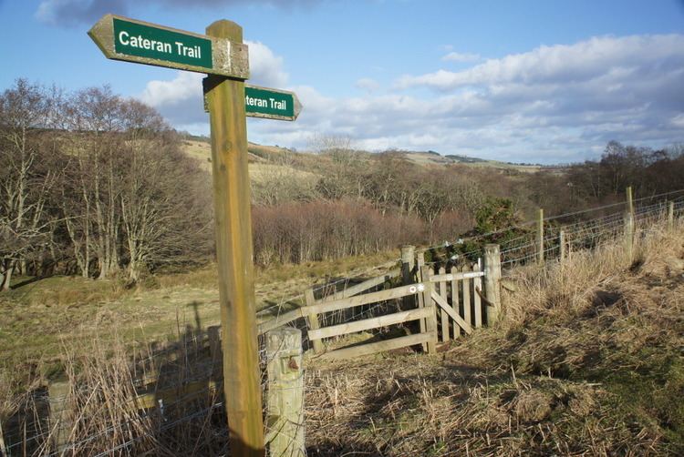
The Cateran Trail is typically walked in 5 stages, with the stopping points being determined by the availability of accommodation and the walker's fitness. Generally, the trail is started at Blairgowrie and the clockwise direction is taken towards Kirkmichael, Spittal of Glenshee, Kirkton of Glenisla then Alyth. Throughout the walk, the path is well marked. Some waymark posts feature gnarled drover's faces carved into the edge of the post while most display the Cateran trail logo; a green ring enclosing a red heart on a white background. Due to the large number of stiles, the trail is mostly unsuitable for cyclists and dogs are prohibited where the path crosses fields with young livestock.
Blairgowrie to Kirkmichael
Starting from the centre of Blairgowrie, the trail follows the River Ericht before climbing onto the wide expanse of Cochrage moor. After descending close to Bridge of Cally, the path comes to a T-junction where walkers can opt to travel towards Kirkmichael or Alyth. Following the signs to Kirkmichael, the trail enters Blackcraig forest and offers some fine views over Strathardle.
This section is approximately 15 miles (24 km).
Kirkmichael to Spittal of Glenshee
Although short at around 8.5 miles (13.7 km), this section of the trail reaches the highest point on the route and so presents its own unique challenges. Skirting Kindrogan wood on the West side of Strathardle, the path passes Tullochcurran Loch before crossing the river into Enochdhu. From here, the trail begins its long ascent through forest and open hillside to the col (An Lairig) between Ben Earb and Meall Uaine. On the ascent there is a wooden shelter known as the Dirnanean Estate upper lunch hut. After the mountain pass, the path quickly descends into Spittal of Glenshee.
Spittal of Glenshee to Kirkton of Glenisla
This leg of the journey begins with a leisurely walk down Glen Shee. Just after Westerton of Runavey, there is an alternative route to the left which climbs through some rough terrain to Loch Beanie and rejoins the main trail at Forter. The main route continues to follow Shee Water to the grounds of the superb Dalnaglar Castle. Now the route follows the B951 to Forter. Another side path climbs Mount Blair, which offers commanding views of the surrounding countryside on a clear day. Between Forter and Kirkton of Glenisla, the trail loops around Auchintaple Loch and descends by Loch Shandra. This section is 14.5 miles (23.3 km) long.
Kirkton of Glenisla to Alyth
Over this stage the scenery mellows as the path returns toward Strathmore. To start this section, walk west on the road from the Glenisla Hotel until the primary school, turn left and cross the iron bridge. Here the path climbs rapidly over moorland before passing by a string of farms. A short diversion to the spectacular Reekie Linn is well worthwhile. Finally the trail passes between Hill of Alyth and Hill of Loyal prior to reach the village of Alyth, a distance of 11 miles (18 km) from the Kirkton.
Alyth to Blairgowrie
North of the village, the trail climbs Hill of Alyth and passes through the extensive Bamff estate. From here, the route follows a quiet country road and passes through some mixed woodland before descending into Bridge of Cally. The final section of the Cateran Trail follows the same track as the very first stage, this time returning to Blairgowrie for a total distance of 16.2 miles (26.1 km).
An alternative, and much shorter route exists between Alyth and Blairgowrie. The trail progresses through the wooded Den of Alyth before passing the Tullyfergus farms and through Drimmie woods into Blairgowrie.