
Country Mexico Elevation 561 m Population 159 (2010) | State Baja California Local time Monday 7:36 AM Municipality Ensenada Municipality | |
 | ||
Time zone Northwest US Pacific (UTC-8) Weather 9°C, Wind NE at 14 km/h, 75% Humidity | ||
Catavi a
Cataviña, Baja California is a small town on Federal Highway 1 in the Mexican state of Baja California. It is located 118 km (74 mi) south of El Rosario and 106 km (66 mi) north of the junction of Federal Highway 12 to Bahía de los Ángeles.
Contents
Map of Catavi%C3%B1a, Baja California, Mexico
The local economy is dependent on tourism, ranching (Rancho Santa Inés, on the outskirts of the town, is an ejido held in common by the residents), and a couple of private vendors selling gasoline from 55 gallon barrels. If you are planning a trip that includes Cataviña, make sure to purchase enough fuel to get from El Rosario to Villa Jesus y Maria, or you'll be buying some of that private vendor gasoline yourself (the Pemex station in Cataviña is closed, permanently.)
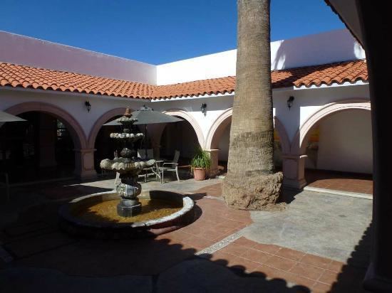
Cataviña has a first-rate hotel developed by the National Fund for the Promotion of Tourism in the Mexican government. Nearby are some cave paintings and a field of giant rocks, mixed with desert vegetation, which make the area a place visited for lovers of ecotourism.
Cataviña is 371 km from Ensenada, and is located almost on the border line of Baja California South. It is 5 hrs by car. Gasoline is an issue, the Pemex station is closed permanently, must bring reserve for return trip.