
Demonym(s) Castricummer Website www.castricum.nl Local time Monday 12:58 PM Area code 0251 | Elevation 0 m (0 ft) Time zone CET (UTC+1) Area 59.92 km² | |
 | ||
Postcode 1489, 1900–1906, 1920–1921 Weather 8°C, Wind NW at 6 km/h, 84% Humidity Points of interest Bezoekerscentrum De Hoep, Huis van Hilde, Strandvondstenmuseum Castricum, Pluktuin Bakkum | ||
Castricum ( [ˈkɑstrikɵm]) is a municipality and a town in the province of North Holland in the Netherlands.
Contents
Map of Castricum, Netherlands
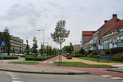
Castricum is a seaside town in the province of North Holland. It draws in a fair share of tourists who mainly come to visit the beach and nearby dune landscape. In Castricum's vicinity there is also the lake of Alkmaar-Uitgeest which offers various sailing and windsurfing opportunities.
History
On 6 October 1799, a Franco-Dutch army under Guillaume Brune defeated an Anglo-Russian army under Ralph Abercromby and the Duke of York in the Battle of Castricum.
Population centres
The municipality of Castricum is made up of the following towns, villages and/or districts: Castricum, Akersloot, Bakkum, De Woude, Limmen.
Transportation
The town is served by Castricum railway station. From here there are 4 trains an hour to Amsterdam, with a journey time of 28 minutes.
Local government
The municipal council of Castricum consists of 23 seats, which are divided as follows:
At the moment, the college van burgemeester en wethouders (the municipal board) is formed by the VVD, CKenG, CDA and D66.