
Population 155 Civil parish Castleton Local time Monday 11:22 AM | OS grid reference ST648168 Sovereign state United Kingdom | |
 | ||
Weather 7°C, Wind W at 18 km/h, 83% Humidity | ||
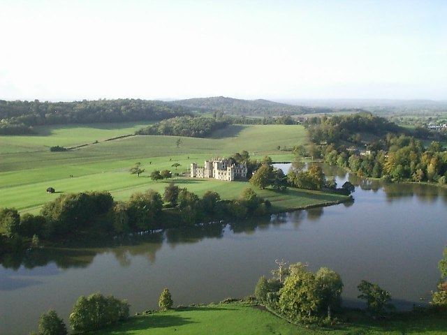
Castleton is a civil parish in the English county of Dorset, lying within the West Dorset administrative district. The parish virtually encircles the town of Sherborne, and contains within its boundary both Sherborne Castle and Sherborne Old Castle. These and other buildings within the parish are today generally regarded as comprising part of Sherborne. In the 2011 census the parish had a population of 155.
Map of Castleton, UK
Roman remains have been found at two sites in the parish: at Pinford Lane, in the east, and near Sandford Lane, in the north. The Pinford Lane site revealed the remains of buildings, an oven or kiln, coins, pottery, brooches and beads. The Sandford Lane site revealed more remains of buildings, coins and one brooch.
Most of the houses in the parish, but not the church, were pulled down when the railway was built through the town. Castleton shares a grouped parish council, Yeohead & Castleton Parish Council, with the three village parishes of Poyntington, Goathill and Oborne.