
Population 344 (2011 census) Postal code 3777 | Postcode(s) 3777 Local time Monday 5:46 PM | |
 | ||
Weather 25°C, Wind SE at 24 km/h, 37% Humidity | ||
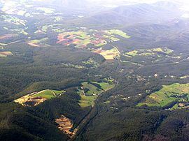
Castella is a small town in Victoria Australia. It lies to the east of Kinglake at the intersection of the Melba Highway and the Healesville Kinglake Road. At the 2011 Census, Castella had a population of 344.
Map of Castella VIC 3777, Australia
The Castella Quarries produces sandstone and crushed rock. One of the quarries was used to dump the drillings from a tunnel under the Toolangi State Forest. This tunnel is part of the Sugarloaf Pipeline, carrying freshwater to Melbourne from the Goulburn River.
References
Castella, Victoria Wikipedia(Text) CC BY-SA