
Country United States FIPS code 29-11638 Elevation 300 m Zip code 64835 Local time Sunday 2:51 PM | Time zone Central (CST) (UTC-6) GNIS feature ID 0715453 Area 6.7 km² Population 1,840 (2012) Area code 417 | |
 | ||
Weather 15°C, Wind S at 31 km/h, 74% Humidity | ||
Carterville is a city in Jasper County, Missouri, United States. The population was 1,891 at the 2010 census. It is part of the Joplin, Missouri Metropolitan Statistical Area.
Contents
Map of Carterville, MO 64835, USA
History
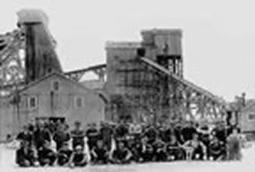
Carterville was laid out in 1875. The community has the name of J. L. Carter, an original owner of the site. A post office called Carterville has been in operation since 1875.
Geography
Carterville is located at 37°8′58″N 94°26′25″W (37.149458, -94.440199). Carterville's main street is the former U.S. Route 66.
According to the United States Census Bureau, the city has a total area of 2.60 square miles (6.73 km2), all of it land.
2010 census
As of the census of 2010, there were 1,891 people, 712 households, and 511 families residing in the city. The population density was 727.3 inhabitants per square mile (280.8/km2). There were 800 housing units at an average density of 307.7 per square mile (118.8/km2). The racial makeup of the city was 94.2% White, 0.4% African American, 0.8% Native American, 0.4% Asian, 2.1% from other races, and 2.0% from two or more races. Hispanic or Latino of any race were 3.9% of the population.
There were 712 households of which 38.1% had children under the age of 18 living with them, 50.4% were married couples living together, 15.9% had a female householder with no husband present, 5.5% had a male householder with no wife present, and 28.2% were non-families. 22.3% of all households were made up of individuals and 8.8% had someone living alone who was 65 years of age or older. The average household size was 2.66 and the average family size was 3.08.
The median age in the city was 34.5 years. 27.7% of residents were under the age of 18; 9.1% were between the ages of 18 and 24; 27% were from 25 to 44; 24.7% were from 45 to 64; and 11.4% were 65 years of age or older. The gender makeup of the city was 48.9% male and 51.1% female.
2000 census
As of the census of 2000, there were 1,850 people, 702 households, and 499 families residing in the city. The population density was 709.4 people per square mile (273.7/km²). There were 792 housing units at an average density of 303.7 per square mile (117.2/km²). The racial makeup of the city was 96.70% White, 0.16% African American, 0.59% Native American, 0.11% Asian, 0.16% Pacific Islander, 0.11% from other races, and 2.16% from two or more races. Hispanic or Latino of any race were 0.92% of the population.
There were 702 households out of which 34.9% had children under the age of 18 living with them, 53.8% were married couples living together, 11.5% had a female householder with no husband present, and 28.9% were non-families. 24.6% of all households were made up of individuals and 9.1% had someone living alone who was 65 years of age or older. The average household size was 2.64 and the average family size was 3.13.
In the city the population was spread out with 28.7% under the age of 18, 8.9% from 18 to 24, 29.5% from 25 to 44, 22.7% from 45 to 64, and 10.2% who were 65 years of age or older. The median age was 34 years. For every 100 females there were 97.2 males. For every 100 females age 18 and over, there were 98.0 males.
The median income for a household in the city was $29,595, and the median income for a family was $34,539. Males had a median income of $26,581 versus $18,276 for females. The per capita income for the city was $12,924. About 10.1% of families and 13.5% of the population were below the poverty line, including 18.1% of those under age 18 and 13.8% of those age 65 or over.