
Primary inflows Surface area 3,200 acres (13 km) Area 12.95 km² Shore length 99.8 km Parent range Blue Ridge Mountains | Basin countries United States Max. depth 547 ft (167 m) Surface elevation 64 m Inflow source Coosawattee River | |
 | ||
Location Blue Ridge Mountains, Gilmer / Murray counties, Georgia, US Type natural lake, reservoir | ||
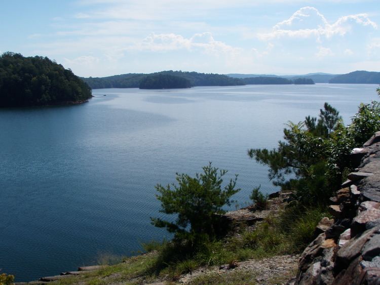
Carters lake near ellijay ga
Carters Lake, the deepest of Georgia's reservoir lakes, is located in the Blue Ridge Mountains in both Gilmer and Murray County. It was named after Farrish Carter who lived in the 19th century. It has a surface area of 3,200 acres (13 km2) and has 62 miles (100 km) of shoreline. Carters Lake is also more than 450 feet (140 m) deep.
Contents
- Carters lake near ellijay ga
- Map of Carters Lake Georgia USA
- Standing on top of carters lake dam ga amazing fishing spot in ga
- References
Map of Carters Lake, Georgia, USA
Carters Lake, owned by the US Army Corps of Engineers, is a man-made lake without private docks or houses along its shore. This lake is fed by the Coosawattee River that runs between Ellijay and Chatsworth. Carters Dam, the tallest earthen dam east of the Mississippi, was completed in 1977. Since then, it has been used to act as a watershed to control annual flooding and generate power. Carters Lake is also used for various forms of outdoor recreation such as fishing, water skiing, hiking, camping, and mountain biking.