- elevation 3,970 ft (1,210 m) Biome Great Basin Desert | Area 777 km² | |
 | ||
A real ufo over norfolk uk
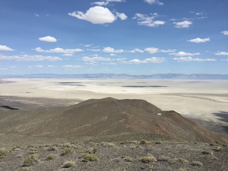
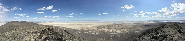
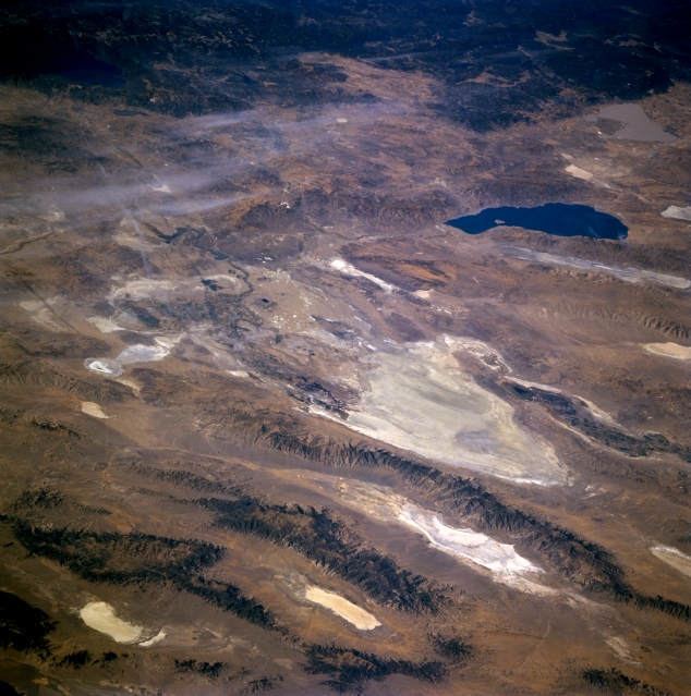
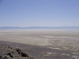
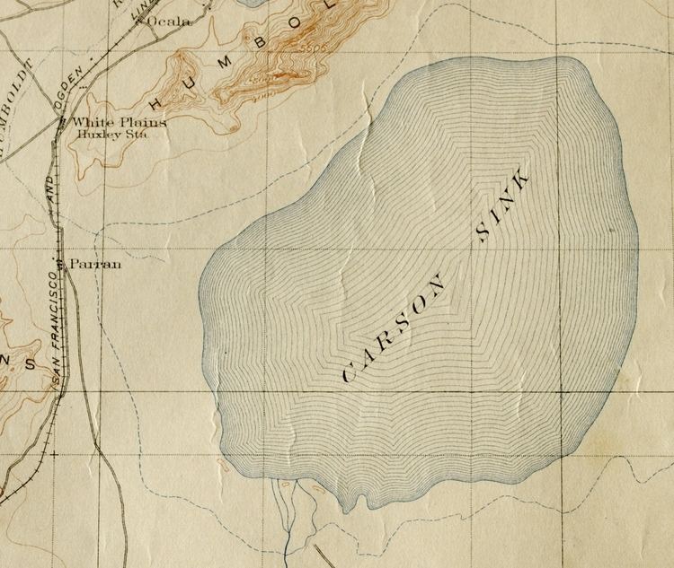
Carson Sink is a playa in the northeastern portion of the Carson Desert that was formerly the terminus of the Carson River. The sink is currently fed by drainage canals of the Truckee-Carson Irrigation District. The southeastern fringe of the sink where the canals enter is a wetland of the Central Basin and Range ecoregion, which is mostly included within the Fallon National Wildlife Refuge and the Stillwater Wildlife Management Area. This area serves as an important stopover for migrating waterfowl. The Sehoo Formation is in the south of the Carson Sink.
Contents
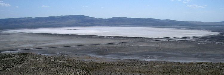
Carson sink
Carson Sink and Lone Rock working areas
The Carson Sink and Lone Rock working areas are the northwest portion of both the Carson Sink and the Fallon Range Training Complex. The Lone Rock working area includes the Bravo-20 range which has numerous targets for combat aircraft training. Lone Rock is in the middle of a Bravo-20 live bombing area and is a solitary pinnacle of rock through the playa that is held sacred by the Paiute.
History
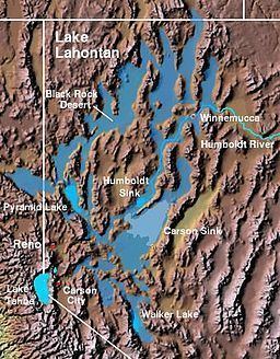
The Carson Sink was a deep portion of the Pleistocene water body Lake Lahontan, the lakebed of which is now the Lahontan Basin.
The Carson Trail used during the California Gold Rush across the Lahontan Basin included a section from through the Forty Mile Desert to the first drinkable water on the Carson River. The Carson Sink station of the Pony Express was built in March, 1860.
In 1984, the natural dike between the Carson Sink and the Humboldt Sink was breached by the Nevada Department of Transportation to prevent Interstate 80 and the town of Lovelock from flooding due to unusually heavy snowfall in the preceding three years. The sinks remained connected by water for 3 years, until 1987.