
Population 176 (2011 census) Postcode(s) 2340 County Buckland Founded 1885 Local time Monday 5:45 AM | Established 1885 LGA(s) Gunnedah Shire Council Elevation 280 m Postal code 2340 Federal division Division of New England | |
 | ||
Weather 17°C, Wind S at 10 km/h, 84% Humidity | ||
Carroll is a parish and small village on the Oxley Highway, 20 km east of Gunnedah, New South Wales. At the 2011 census, Carroll had a population of 176 people. The Namoi River runs approximately parallel to the highway which is also the main street there. Periodically this river floods the town and surrounding area, forcing the closure of the Oxley Highway. The surrounding area is part of the Liverpool Plains region. Carroll is an Aboriginal word for 'forked tree'.
Map of Carroll NSW 2340, Australia
In 1839 John Howe of Windsor took out a Depasturing Licence for 'Carrol'. An adjoining 'Carrol' was held by Hannah Dight in 1846.
During December 1865 Captain Thunderbolt (Fred Ward) and two accomplices robbed the inn at Carroll then danced and drank until the police arrived. They wounded a policeman and escaped, abandoning three pack-horses.
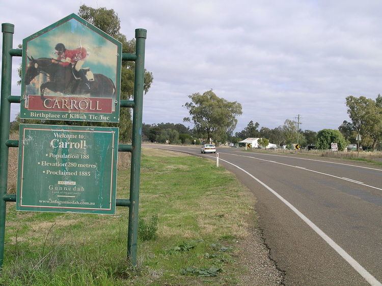
The district produces cotton, wheat, other grains, fat lambs and beef cattle. The Olympic eventing horses, Kibah Tic-Tic, a noted dual gold medal winner and Kibah Sandstone (gold medalist in team & individual 1992, gold 2000) were bred on Kibah, a property close to the village.
According to the entry sign there are 188 people in the village. The village now has a public school and a fuel supplier.