
Topo map USGS Ogilby | Mountains Pilot Knob | |
 | ||
Elevation 2,219 ft (676 m) NAVD 88 District | ||
Driving in the cargo muchacho mountains west of yuma az
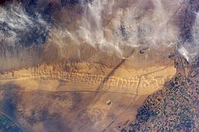
The Cargo Muchacho Mountains are located in the southeast Colorado Desert in the Lower Colorado River Valley, in Imperial County, California in the United States. Much of the range's geology was described by the geologist John T. Dillon.
Contents
- Driving in the cargo muchacho mountains west of yuma az
- Map of Cargo Muchacho Mountains California 92283 USA
- Old mining district the cargo muchacho mountains mines
- Geography
- References
Map of Cargo Muchacho Mountains, California 92283, USA
Old mining district the cargo muchacho mountains mines
Geography
The range lies in a northwest-southeasterly direction, southeast of the Imperial Valley and northwest of the Colorado River and Yuma, AZ–Winterhaven, CA. The range lies south and southeast of the Chocolate Mountains and east of the Algodones Dunes. Pilot Knob is a volcanic plug formed landmark peak to the south of the range.
The mountains are home to the American Girl Mine, and the Golden Bee and Cargo mines. The All American Canal passes to the south of the range.
References
Cargo Muchacho Mountains Wikipedia(Text) CC BY-SA