
First ascent unknown Province Province of Tarragona | Elevation 942 m Highest point Creu de Santos | |
 | ||
Similar Creu de Santos, Morral de Cabrafeixet, Balneari de Cardó, Serra del Montsià, Aligars‑Serra Fulletera | ||
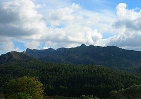
The Cardó Massif (Catalan: Massís de Cardó, [məˈsiz ðə kərˈðo], [maˈsiz ðe karˈðo]; Spanish: Macizo de Cardó), also known as Cardó-Boix Massif, is a mountain massif in the Baix Ebre comarca, in Catalonia, Spain. This massif is composed of a number of mountain ranges located on the left side of the Ebro river near Tortosa. The massive calcareous cliffs of the Serra de Cardó form the eastern side of the spectacular gorges through which the Ebro River winds its way in the final stage of its course, separating the Ebro Valley from the Mediterranean coastal area.
Contents
Map of Card%C3%B3 Massif, 43511, Tarragona, Spain
The ranges cover an area of over 340 km2, extending from Rasquera in the north, to Benifallet in the south and eastwards through El Perelló until reaching the Mediterranean Sea between L'Ampolla and L'Ametlla de Mar. Highway N-340 crosses the eastern side of the massif and Autopista AP-7 skirts the easternmost foothills by the seashore.
All the ranges are part of the Catalan Pre-Coastal Range. The main peak is Xàquera, also known as La Creu de Santos (942 m) in the Serra de Cardó, another important summit is Buinaca (764 m), located in the Serra del Boix.
Balma de Cabrafeixet is a prehistoric site below the Morral de Cabrafeixet escarpment (753 m) with cave paintings. The entrance to the cave has been closed with an iron bar door to prevent vandalism. Another cave, Cova de la Mallada, is located nearby
There are many wind turbines located on different ridges of the massif, the Parc Eòlic de les Colladetes and the Parc Eòlic de les Calobres.
Ranges
The main ranges of the massif are:
Monastery
The Cardó Monastery, also known as Sant Hilari de Cardó or Desert de Cardó, was a large monastery located in the Cardó Valley (Vall de Cardó), a deep valley in these mountains. It was closed down due to the Ecclesiastical Confiscations of Mendizábal in 1835 during Isabella II of Spain's rule. The Desamortización or secularization of the place brought monastic life in the monastery, and the many hermitages surrounding it, to an end. The monastery can be reached by a paved road from Rasquera.
In the late 19th century the monastery was transformed into a spa, which became a very successful place among the Catalan elite until the Spanish Civil War. By mid 20th century, only a water bottling plant was functional in the area.
Recently there was a project to transform the ruined former monastery and spa premises into a luxury resort, but the current financial crisis in Spain thwarted the plans. Access is not allowed to the grounds of the former spa, but abandoned construction equipment can be seen from a distance among the half-ruined buildings.
The small abandoned hermitages scattered about the area close to the former monastery, some of them perching atop karstic rock needles, are popular with hikers.