
Incorporated July 15, 1903 Area 642.7 km² | Founded 1861 Barangays Local time Friday 5:57 AM | |
 | ||
Weather 24°C, Wind N at 6 km/h, 91% Humidity Neighborhoods Sebio, Brgy. Alvar, Rizal, Magsayap, Santiago, San Pedro, Manurigao, Central, San Pedro Centro, San Jose, Baculin B | ||
Caraga is a 1st class municipality in the province of Davao Oriental, Philippines. According to the 2015 census, it has a population of 40,379 people.
Contents
- Map of Caraga Davao Oriental Philippines
- Geography
- Land area
- Barangays
- History
- Demographics
- Language
- Economy
- Attractions
- Transportation
- References
Map of Caraga, Davao Oriental, Philippines
Geography
The municipality is located 254 kilometres (158 mi) from Davao City, the regional center of Region XI, and 84 kilometres (52 mi) from Mati, the capital town of the province of Davao Oriental on the island of Mindanao. It lies along the eastern coast of this province, facing the Pacific Ocean. It is bounded in the north by the Municipality of Baganga in the south by the municipality of Manay, in the west by the Municipality of New Bataan, Compostela Valley Province, and on the east by the Pacific Ocean. Pusan point of Barangay Santiago is the easternmost point of the Philippines.
Caraga coastline is irregular and the municipality is traversed by the two rivers: Caraga River in the south and Manurigao River in the north.
Land area
Caraga has a total land area 64,270 hectares (158,800 acres), representing 12.45% of the total land area of the Province of Davao Oriental, and seventeen (17) barangays. Barangay Pichon occupies the largest land area with 16,300 hectares (40,000 acres) which are 25.35% of the total land area of the municipality. Barangay D.L Balante, which is located in the south-west of Barangay Poblacion, is the smallest barangay with a land area of 975 hectares (2,410 acres) or 1.51% of the total land area of this municipality.
Barangays
Caraga is politically subdivided into 17 barangays.
History
The official founding of the town was in 1861 along with Mati, making it one of the oldest towns of the province of Davao Oriental.
The etymology of the word "Caraga" is said to have originated from the native word "Kalag" which means "spirit of soul". Hence, the whole Provincia de Caraga of 1622 was called "region de gente animosa", that is "region of spirited men". This being "spirited men and women" is grounded on its cultural, religious and political background. With culture, Caragans were spirited in view of their closeness to nature and attitude towards the creation. With religiosity, Caragans were spirited as to their belief on the spirits of nature (like the trees "balete tree", the rivers and mountains, sun and moon); in fact, they have "anito worship" and "ancestor worship" led by the dancing priestess (balyan) and the singing priestess (catalunan). With primitive politics, Caragans were spirited as they invited a "bagani system" of governance. A "bagani" is like a "warrior" kinglet or datu" who ruled by banditry and by occupation.
Demographics
Based on the 2010 census, the Municipality has a total population of 36,912 people, or about 7.1% of the total population of the province.
Of the 17 barangays comprising the municipality, Pichon has the highest population of 5,188 or 14.1% of the municipality's population. Barangay Poblacion is the second population barangay at 4,710 equivalent to 12.8% of the total population and this is closely followed by Barangay Sobrecarey which has a population of 4,544 or 12.3% of the population of Caraga.
Barangay Alvar is the least populated barangay contributing only 1.7% or 627 persons to the total populations. It is followed by Barangay San Miguel, which has 833 people, and Brgy. D.L. Balante which has population of 834 or 2.3% of the entire population.
Language
Household population by mother tongue (based on 1990 participation rate):
Economy
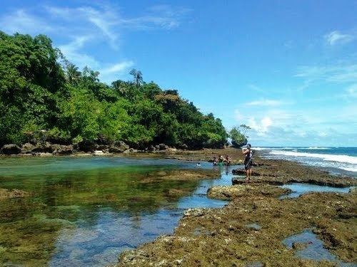
Coconut products are the inhabitants main source of income aside from some lucrative business. It has a number of eco-tourism resources like the Caraga Lagoon, San Luis Beach, Pusan Point, and some historical heritage like the San Salvador Church Bell from 1802, and the Caraga Fortification with 80 feet (24 m) high stone-built walls.
The municipality of Caraga has sixteen (16) wholesale trade establishment which are mostly involved in the buy and sell agricultural products. Four of these establishment are found in Barangay Poblacion while the rest are found in other Barangays. Retail establishment, which includes repair/welding shops, dormitory, lodging houses, cable television, telephone services providers, total to 23, most of which are found in the Poblacion.
The present industries thriving in the locality are the agriculture based, presently there are nine (9) rice /corn mills found in Barangay San Luis, San Antonio, Poblacion, San Pedro, San Jose, and P.M Sobrecarey. There are also one (1) furniture shop in the poblacion and one (1) handicraft industry making dagmay novelties.
Attractions
Scenic spots:
Transportation
The Davao Oriental–Surigao Coastal Highway passes through the municipality mostly along the coastal area with a total stretch of 33.462 kilometres (20.792 mi). Provincial Roads which branch out from the National Road to the barangays of P.M Sobrecarey and San Pedro amount to 32.079 kilometres (19.933 mi). The Municipal Roads which are located in the Urban center of Poblacion have a total stretch of 4.968 kilometres (3.087 mi), 1.316 kilometres (0.818 mi) of which are cemented and the remaining 3.652 kilometres (2.269 mi) are mostly all weather graveled roads.
The municipal has 14 bridges. 4 of these bridges are reinforced concrete, located along the national Road.