
 | ||
Similar Etosha National Park, Fish River Canyon, Chobe National Park, Bwabwata National Park, Popa Falls | ||
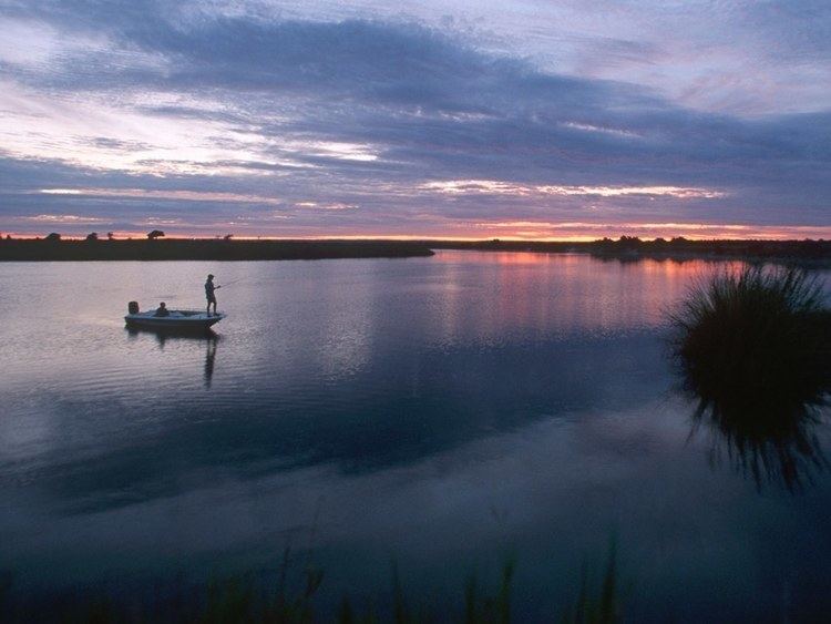
Crossing the caprivi strip namibia
Caprivi, sometimes called the Caprivi Strip (in German: Caprivizipfel), Okavango Strip and formerly known as Itenge, is a narrow protrusion of Namibia eastwards from the Kavango Region about 450 km (280 mi), between Botswana to the south, and Angola and Zambia to the north. Caprivi is bordered by the Okavango, Kwando, Chobe and Zambezi rivers. Its largest settlement is the town of Katima Mulilo. It went through a civil war from 1994–1999. The strip is administratively divided between the eastern Zambezi Region and the western Kavango East Region.
Contents
- Crossing the caprivi strip namibia
- Victoria falls chobe and the caprivi strip
- Languages
- Natural features
- History
- Politics
- Caprivi conflict
- References
Victoria falls chobe and the caprivi strip
Languages
Inhabitants of the Caprivi Strip speak a number of African languages, mostly members of the Bantu language family, with speakers of Hukwe, a San language, in the northwest of the strip (on the Namibia-Angola border). The Bantu languages include Yeyi (or 'Yei' or 'Yeeyi'), Mbukushu, Gciriku (or 'Dciriku'), Fwe, Totela, and Subiya. Perhaps a majority in the Caprivi Strip, especially in the capital town of Katima Mulilo, speak Lozi as a lingua franca. Many also speak some English and Afrikaans.
Natural features
The area is rich in wildlife and has mineral resources. Of particular interest to the government of Namibia is that it gives access to the Zambezi River and thereby a potential trading route to Africa's East Coast. However, the vagaries of the river level, various rapids, the presence of Victoria Falls downstream and continued political uncertainty in the region make this use of the Caprivi Strip unlikely, although it may be used for ecotourism in the future.
Within Namibia the Caprivi Strip provides significant habitat for the critically endangered Wild African Dog, Lycaon pictus. It is a corridor for African elephant moving from Botswana and Namibia into Angola, Zambia and Zimbabwe. National Parks found in the Caprivi Strip are Bwabwata National Park, Mudumu National Park and Nkasa Rupara National Park. Local communities have organised themselves into communal area conservancies and community forests. People work closely with the Namibian Government to jointly manage natural resources through several programmes set up between the Namibian Government and various donors.
History
Caprivi was named after German Chancellor Leo von Caprivi (in office 1890–1894), who negotiated the acquisition of the land in an 1890 exchange with the United Kingdom. Von Caprivi arranged for Caprivi to be annexed to German South-West Africa in order to give Germany access to the Zambezi River and a route to Africa's east coast, where the German colony Tanganyika was situated. The river later proved unnavigable and unaccessable to the Indian Ocean due to Victoria Falls. The annexation was a part of the Heligoland-Zanzibar Treaty, in which Germany gave up its interest in Zanzibar in return for the Caprivi Strip and the island of Heligoland in the North Sea.
In the late 20th century, the Caprivi Strip attracted attention as Namibia and Botswana took a long-standing dispute over its southern boundary to the International Court of Justice. The core of the territorial dispute concerned which channel of the Chobe River was the thalweg, the bona fide international boundary. This was important, as, depending on the decision, a large island (known as Kasikili or Seddudu by Namibia and Botswana, respectively) would fall into national territory. The Botswana government considered the island as an integral part of the Chobe National Park, whereas the Namibian government, and many inhabitants of the eastern Caprivi Strip, held that not only was the island part of the original German–British agreement, but that generations of inhabitants had used it for seasonal grazing, for reed-gathering, and as a burial site. In December 1999, the International Court of Justice ruled that the main channel, and hence the international boundary, lay to the north of the island, thus making the island part of Botswana.
Politics
The Caprivi Strip is of politico-strategic military importance. During the Rhodesian Bush War (1970–1979), African National Congress operations against the South African government (1965–1994) and the Angolan Civil War (1975–2002), the Strip saw continual military action and multiple incursions by various armed forces using the Strip as a corridor to access other territories.
South African administration of South-West Africa recommended self-governance for the Caprivi, a plan that was partly realised in 1976 when the "Caprivi government" was formed and received its own flag, national anthem, and coat of arms.
Caprivi conflict
The Caprivi conflict involved an armed conflict in Namibia between the Caprivi Liberation Army (CLA), a rebel group aiming for the secession of the Caprivi Strip led by Mishake Muyongo, and the Namibian government. Its main eruption occurred on 2 August 1999 when the CLA launched an attack in Katima Mulilo, occupying the state-run radio station and attacking a police station, the Wanella border post, and an army base. Namibian armed forces quashed the attempt at secession within a few days.