
Country Australia Basin area 653 km² | Length 32 km | |
 | ||
River mouth Geographe Baysea level Basin size 653 square kilometres (252 sq mi) | ||
Using capel river seo to advertise products or services contact 1800 seo 888
The Capel River is a river in the South West of Western Australia that rises in the Darling Range east of Mullalyup, and flows into the Indian Ocean at Peppermint Grove Beach.
The river was named after Capel Carter Brockman (1839–1924), daughter of John Bussell (1803–1875), who was named after a Miss Capel Carter, a cousin of the Bussells in England with whom the Bussell family members corresponded.
The Capel River is the largest in the Geographe catchment. It rises at the edge of the Darling Scarp and flows in a north-westerly direction across the northern part of the Blackwood plateau to the confluence of the Capel River North and Capel River South, near Goodwood.
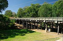
The river crosses the Bussell Highway near Capel.
An artificial river mouth was cut through the sand dunes adjacent to the Stirling Wetlands in 1880 to allow it to flow directly into Geographe Bay.
The Capel river has 6 tributaries; Capel River North, Capel River South, Gynudup Brook, Camp Gully, Layman Gully and Maidenhair Gully.
The inaugural 2009 Ranger Outdoors Capel Descent was held in June 2009 which consisted of a 15 kilometres (9 mi) part down river, part open ocean paddle along the Capel River and Geographe Bay.