
 | ||
Similar Lighthouse at Cape Trafalgar, La Breña y Marismas del Barba, Tómbolo de Trafalgar, Costa de la Luz, Baelo Claudia | ||
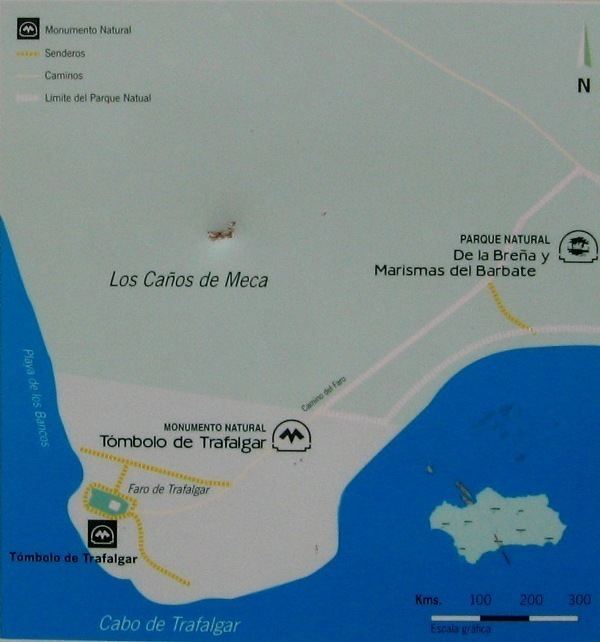
Cape Trafalgar (/trəˈfælɡər/; Spanish: Cabo Trafalgar [ˈkaβo tɾafalˈɣaɾ]) is a headland in the Province of Cádiz in the south-west of Spain. The 1805 naval Battle of Trafalgar, in which the Royal Navy decisively defeated Napoleon's combined Spanish and French fleet, took place off the cape.
Contents
Map of Cape Trafalgar, 11159, C%C3%A1diz, Spain
It lies on the shore of the Atlantic Ocean, northwest of the Strait of Gibraltar at 36°10'58"N, 6°2'2"W. The International Hydrographic Organization defines the Western limit of the strait and the Mediterranean Sea as a line that joins Cape Trafalgar to the North to Cape Spartel to the south.
The most prominent structure on the cape is a 34-metre-high lighthouse (51 metres above sea level), the faro de Cabo Trafalgar, built in 1860.
Etymology
The name is of Arabic origin, Taraf al-Ghar (طرف الغار 'cape of the cave/laurel'). Or corresponding possibly to Taraf al-Gharb (طرف الغرب 'cape of the west')
In both cases, taraf (طرف) literally means 'edge' or 'extremity' and hence refers to a promontory (edge of the land).
In modern Arabic, however, the place is sometimes re-transcribed as al-Taraf al-Aghar (الطرف الأغر).