
 | ||
Cape san blas florida 4br gulf view vacation rental home 201 park point circle
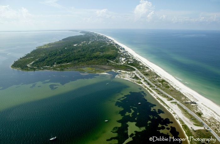
Cape San Blas is part of a peninsula in Gulf County, Florida extending westward from the mainland of Florida, separating St. Joseph Bay to the north from the Gulf Of Mexico to the south. The St. Joseph Peninsula extends northward from the west end of Cape San Blas. It is approximately 10 miles south-southwest of the town of Port St. Joe, located at coordinates 29°39′49″N 85°21′20″W.
Contents
- Cape san blas florida 4br gulf view vacation rental home 201 park point circle
- Map of Cape San Blas Florida 32456 USA
- History
- References
Map of Cape San Blas, Florida 32456, USA
History
Cape San Blas was home to a Confederate Saltworks where 150 bushels of salt a day were processed by evaporation of seawater. This halted in 1862 when a landing party from the Union ship, the USS Kingfisher, destroyed the saltworks.
Cape San Blas has had 4 lighthouses. The first, built in 1847, collapsed during a gale on August 23–24 of 1851. Congress appropriated $12,000 for a second brick tower lighthouse for the cape which was finally finished in November 1855, but it was destroyed on August 30, 1856, when another hurricane struck Cape San Blas. On May 1, 1858 a 3rd lighthouse was completed and lit. During the Civil War the lighthouse was not in commission but resumed operations July 23, 1865. Over the years, erosion began eating away at the lighthouse. In 1883 the 4th iron frame lighthouse was constructed.