
Population Uninhabited | Highest point 401 m (1,316 ft) Area 10 km² | |
 | ||
Archipelago Canadian Arctic Archipelago | ||
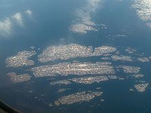
The Cape Chidley Islands are members of the Canadian Arctic Archipelago in the territory of Nunavut. They are located in the Labrador Sea at the south end of the entrance to the Hudson Strait, north of Killiniq Island's Cape Chidley, and separated from Killiniq Island by the MacGregor Strait.
Map of Cape Chidley Islands, Baffin, Unorganized, NU, Canada
Cabot Island is the eastern of the two islands and is 2 mi (3.2 km) long. It has two summits, the northern one being 401 m (1,316 ft) above sea level, and the southern one being 325 m (1,066 ft) high.
Pert Island is the smaller of the two islands and is located 0.5 mi (0.80 km) mile to the west. Its highest point is 385 m (1,263 ft) above sea level. Port Burwell lies 20 km (12 mi) west of Pert Island.
References
Cape Chidley Islands Wikipedia(Text) CC BY-SA