
 | ||
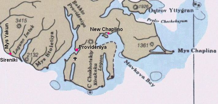
Cape Chaplin or Cape Chaplino (Russian: Мыс Чаплина; Mys Chaplina; Eskimo–Aleut: Angazik) is a cape pointing eastward in the Bering Sea in the Chukotka Autonomous Okrug of the Russian Federation.
Contents
Map of Mys Chaplina, Chukotka Autonomous Okrug, Russia, 689271
The area was first surveyed described and mapped by Russian mariner Count Fyodor Petrovich Litke during the First Kamchatka Expedition and it was named by Litke in honor of midshipman Peter Chaplin Avraamovich, a member of the expedition.
Geography
This headland is located in an area of narrow beach ridges and swales which form a roughly triangular lagoon.
Cape Chaplino was the site of the Yupik village named Ungazik (Chaplino; Unisak on USCGS charts) which gave its name to the Chaplinski dialect of the Siberian Yupik language. The cape is shown as "Indian Point" on a USCGS chart from 1897.