
 | ||
Canol heritage trail
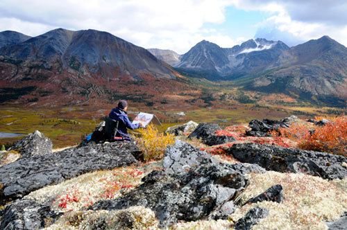
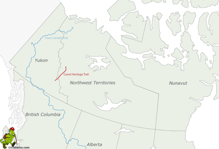
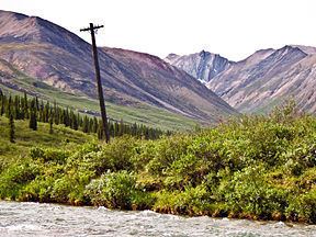
The Canol Heritage Trail is a 355-kilometre-long (221 mi) trail running from Norman Wells, Northwest Territories, through the Mackenzie Mountains, to the Yukon border. Because of its remoteness, length and river crossings, it is considered one of the most challenging trails in Canada. The trail is in the process of becoming a territorial park.
Contents
- Canol heritage trail
- See the world 13 the wild and beauty of the north the canol heritage trail
- History
- Logistics
- Environmental clean up and park status
- Other modes of travel
- References
See the world 13 the wild and beauty of the north the canol heritage trail
History
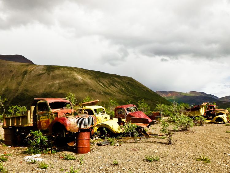
The trail follows the route of the Canol Road lying within the Northwest Territories where it is no longer maintained beyond the Yukon border. The road was constructed during the Second World War by the United States Army Corps of Engineers to build and service a pipeline bringing oil from Norman Wells to a refinery in Whitehorse, Yukon. Though built at huge expense, it was abandoned after only thirteen months of operation.
Main articles: Canol Road and Canol pipeline
Logistics
The trail’s eastern terminus is across the Mackenzie River from Norman Wells requiring arrangements to be made to cross the river by either air or boat. The western terminus can be reached by plane from either Norman Wells or Whitehorse. In summer, it can also be reached by road along Yukon Highway 6/North Canol Road. The road receives minimal maintenance and can be a rough ride up to the Yukon-NWT border where it is no longer maintained and quickly becomes impassable to most vehicles. The western end of the trail is officially the airstrip at Mile 222 in the NWT. The small airstrip at Macmillan Pass near the Yukon border is also used, which brings the total distance to the Mackenzie River to 381 km.
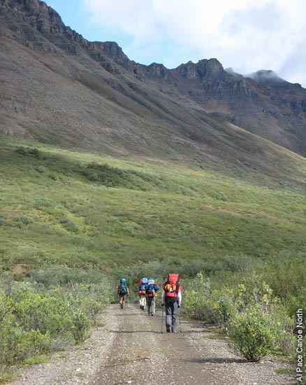
Due to its length and difficulty, it should only be undertaken by experienced and fit hikers. Most hikers will take between 14 and 22 days to complete the trail. There are no services along the trail and, though it has been hiked with no resupply, most people arrange for one to three food drops to be made by aircraft.
There are three major river crossings along the trail—the Twitya, Little Keele and the second crossing of the Carcajou—in addition to many smaller ones that may be difficult depending on water levels. A hiker died in 2016 after being swept away crossing the Little Keele. The largest crossing is the Twitya River which has turned back many travellers and normally requires swimming or some type of raft to be used. However in 2016 a cable ferry system was installed to provide a safer crossing.
The trail crosses grizzly bear and black bear habitat, so precautions should be taken.
Environmental clean-up and park status
After the Americans decided the Canol project was a failure, it was abandoned and sold for scrap to Imperial Oil. Some valuable equipment was salvaged but a great deal of pipeline, wire, vehicles and buildings remain as well as various contaminants. Clean-up of telegraph wire began in 2015 and at the end of 2016 over 70% of wire on the trail had been removed. In 2016 the Government of Canada was preparing to tender for the clean-up of the entire trail. Remediation of the trail will allow the creation of a territorial park to proceed as set out in the Sahtu Dene and Metis Comprehensive Land Claim Agreement.
Other modes of travel
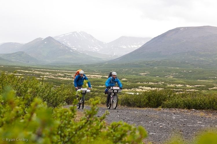
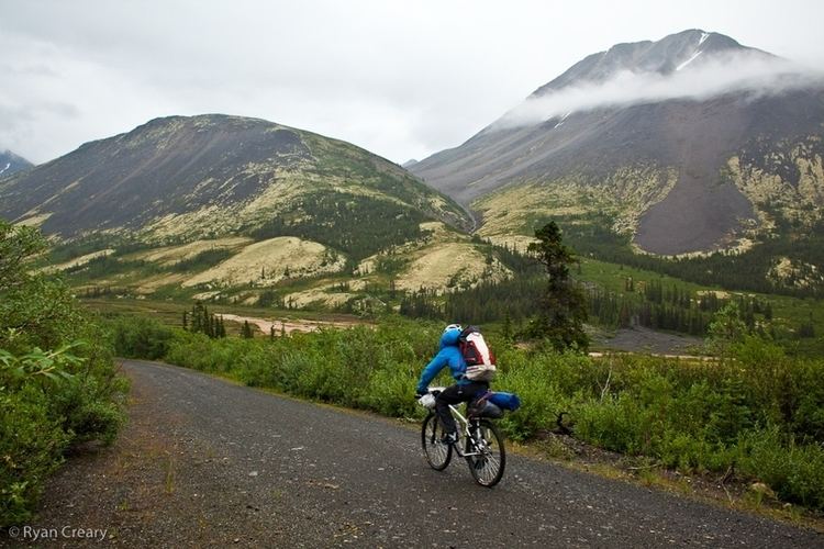
In 2012 the trail was completed in eight days, with no food drops, from Macmillan Pass to the Mackenzie River using mountain bikes and packrafts.
The trail has been traversed by snowmobile and dog team in the winter and by ATV in the summer.
Trail damage from unsuccessful Land Rover attempts in 2009 and 2011 sparked controversy in the Northwest Territories over motorized use of the trail.