
Length 88 km (55 mi) Maximum boat beam 5.05 m (16.6 ft) Minimum height above sea level 60.55 m (198.7 ft) Date completed 1835 Locks 44 | Maximum boat length 38.5 m (126 ft) Maximum height above sea level 151.3 m (496 ft) Date approved 1820 Date of first use 1831 | |
 | ||
Connects to Meuse, Canal de l'Est, Canal latéral à l'Aisne | ||
From revin to the canal des ardennes via montherme and charleville mezieres on the canal de la meuse
The Canal des Ardennes (Ardennes Canal) is a Summit level canal built to the Freycinet gauge between the river valleys of the Aisne and the Meuse.
Contents
- From revin to the canal des ardennes via montherme and charleville mezieres on the canal de la meuse
- Map of Canal des Ardennes France
- Physical CharacteristicsEdit
- HistoryEdit
- Appearance of a WeedEdit
- PortsEdit
- References
Map of Canal des Ardennes, France
Physical CharacteristicsEdit
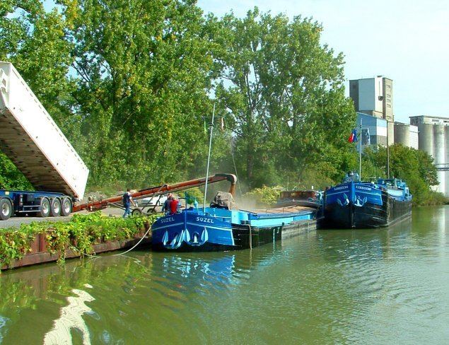
The Canal des Ardennes is 87.779 km long and has 44 locks (37 on the Aisne side and 7 on the Meuse side) with a tunnel to Saint-Aignan.
The Canal connects the village of Pont-à-Bar in the Dom-le-Mesnil commune (08) to the commune of Vieux-lès-Asfeld (08). The first part of the canal is 39 km long ando crosses the threshold between the valleys of the Meuse and the Aisne by following the Bar Valley, diverting briefly at Saint-Aignan for a shortcut through a tunnel. On this part to the summit level it is powered by a supply of water from the Lac de Bairon and water pumped from the Meuse. After the summit is reached it quickly descends to the Aisne by a series of 26 locks over just 9 km. From Semuy the canal closely follows the course of the Aisne. In places it even follows the old river bed and has many turns as the river has been diverted into very straight sections. On the Aisne side it is powered by regular water intake from the river (the Vouziers, Rilly, Givry, Biermes, and Asfeld dams).
On the Aisne side there is a branch 12.066 kilometres long for a drop of nearly 9 m. This is the Vouziers Branch, also called the Canal de Vouziers. This branch leads from Vouziers to Semuy along the Aisne and has 4 locks.
The canal has the distinction of having two separate parts and two series of locks, as if it was composed of two distinct canals. The first is the portion from the Meuse to the Aisne river at the junction to the Vouziers Branch (Pont-à-Bar to Semuy, 39 km) with the second part entirely parallel to the Aisne beginning at Vouziers and continuing parallel to the Aisne to Semuy (59 km).
HistoryEdit
The first canal projects in the region date from 1684 under the Louvois ministry and consisted of using and extending the course of the Bar which was then navigable. Various proposals were made over the decades and, in letters patent of June 1776 - almost a century later, the Prince of Conti was granted the privilege of its construction and operation. The prince died shortly after and nothing was done. After the French Revolution of 1789 the National Constituent Assembly relaunched the project but found fault with previous studies and the project did not proceed.
In "Year VIII" (1800), the local general councilors reminded the government of the project. The prefect Joseph Frain supported and argues for the canal, on the basis of a new route, in a report on 4 October 1800 to the Interior Minister, Lucien Bonaparte. The subsequent Interior Minister, the scientist Jean-Antoine Chaptal, agreed to undertake construction but granted only very limited funds. Work began slowly It became more important during the Bourbon Restoration with the launch in 1820 of a loan to finance the project.
The opening of the canal took place between 1827 and 1835 with modernization between 1842 and 1846. The Vouziers Branch was opened to shipping in 1836. For the part parallel to the Aisner downstream of Lock No. 26 at Rilly initially, until the dams were built, these parts of the navigable canal were connected by a series of artificial reaches.
From 1842 to 1845 improvements were being made, in particular through the creation of the reservoir and the artificial Lake Bairon.
Appearance of a WeedEdit
The plant Matricaria discoidea (Pineapple weed, wild Chamomile), a native of North America, appeared in 1861 along the Canal des Ardennes and then from 1880 to 1895 in the North of France. It spread so rapidly that it displaced the native Tripleurospermum inodorum "to seem as native as he".