
OS grid reference TL0523 Post town SHEFFORD Local time Tuesday 5:09 PM | Sovereign state United Kingdom Postcode district SG17 Dialling code 01462 | |
 | ||
Weather 9°C, Wind S at 10 km/h, 62% Humidity | ||
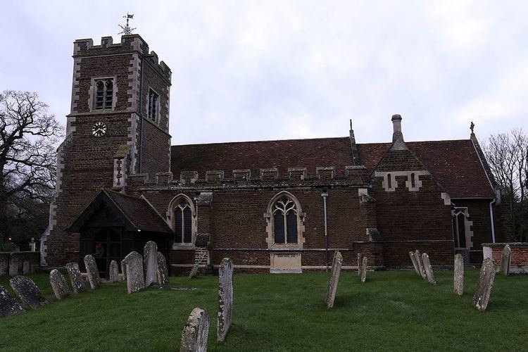
Campton is a village in the Central Bedfordshire district of Bedfordshire, England. It is part of the civil parish of Campton and Chicksands (population 1,699) with the nearby Chicksands. It is about 9 miles (14 km) south of Bedford, and is about 9 miles (14 km) north-west from Letchworth and sits on a tributary of the River Ivel. It is just to the west of Shefford. The 13th century Church of All Saints is in the centre of the village.
Map of Campton, Shefford, UK
Campton is mentioned in the Domesday Book. The entry reads: Chambeltone: Ralph de Lanquetot from Walter Giffard; Fulbert from Willian d'Eu; Thurstan.
Chicksands is to the north of the village, and consists almost entirely of the wooded Chicksands Priory estate. It was used as an American military base until 1995 and is now used as the British Intelligence & Security Centre (since 1997).
For local government purposes it forms part of Central Bedfordshire Council and is within the Mid Bedfordshire parliamentary constituency, whose MP is currently Nadine Dorries of the Conservative Party.