
Elevation 880 m (2,890 ft) | Time zone BRT/BRST (UTC-3/-2) | |
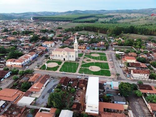 | ||
Campo Limpo de Goiás is a municipality in central Goiás state, Brazil. It separated from the municipality of Anápolis in 1997.
Contents
- Map of Campo Limpo de GoiC3A1s State of GoiC3A1s Brazil
- Demographic and Political Data
- Economy
- Health and education
- References
Map of Campo Limpo de Goi%C3%A1s - State of Goi%C3%A1s, Brazil
The distance to the state capital, Goiânia, is 75 km and connections are made by BR-153, passing through Anápolis, and then taking GO-330.
Demographic and Political Data
Economy
The economy is based on cattle raising (17,500 head in 2006), both for meat and dairy. There are also banana, corn, rice, sugarcane, and soybean plantations.
Agricultural data 2006
Health and education
References
Campo Limpo de Goiás Wikipedia(Text) CC BY-SA