
Municipality Camiri Municipality Time zone GMT-4 Area 22 km² Local time Tuesday 7:05 AM Number of airports 1 | Elevation 812 m (2,664 ft) Area code(s) +591 3952 Population 35,712 (2012) | |
 | ||
Weather 23°C, Wind W at 0 km/h, 99% Humidity | ||
Camiri bolivia
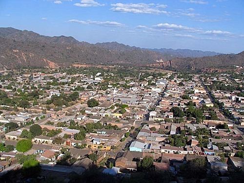
Camiri (Camirito, La Bomba, Choreti, Capital Petrolera de Bolivia) is a city in Bolivia, Santa Cruz Department, Cordillera Province. It is the seat of the Camiri Municipality. The town has an estimated population of 65,897 inhabitants, also known as "Camireños". Camiri is located on the shores of the Parapeti River in a small valley surrounded by rolling hills on the East, North, and South, and by the Aguarague mountain range on the West. Camiri's "Chaco" Ecosystem encompasses subtropical dry forests with low canopy, and intense xerophilic overgrowth with a large diversity of wildlife.
Contents
Map of Camiri, Bolivia
On February 3, 2007, local protesters shut down a natural gas pipeline in Camiri that serves Southern Bolivia. The protesters were seeking an expansion of the nationolization of the natural gas industry and a renewal of the promise of construction of facilities for YPBF, the national petroleum company.
Camiri bolivia oil capital and chaco war site
Climate
Camiri has a humid subtropical climate (Köppen: Cwa).