
Transit type Guided busway Began operation 7 August 2011 Operator Go Whippet | Website www.thebusway.info System length 25,750 m | |
 | ||
Locale Cambridgeshire, United Kingdom | ||
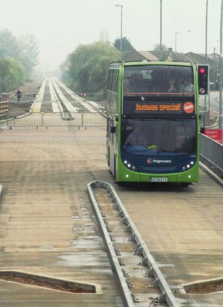
The cambridgeshire guided busway
The Cambridgeshire Guided Busway, known locally as The Busway, connects Cambridge, Huntingdon and St Ives in the English county of Cambridgeshire. It is the longest guided busway in the world, overtaking the O-Bahn Busway in Adelaide, South Australia.
Contents
- The cambridgeshire guided busway
- Map of Cambridgeshire Guided Busway Milton Cambridge CB4 UK
- Overview
- Route
- Infrastructure
- Services
- Ticketing
- Planning
- Construction
- Delays
- Trials
- Operation
- Expansion
- Construction costs
- BAM Nuttall dispute
- Future proposals
- Southern extensions
- Newmarket Road
- Other proposals
- Incidents
- References
Map of Cambridgeshire Guided Busway, Milton, Cambridge CB4, UK
Two guided sections make up 16 miles (25 km) of the route. The northern section, which uses the course of the Cambridge and Huntingdon railway, runs through the former stations of Oakington, Long Stanton and Histon. The southern section, which uses part of the former Varsity Line to Oxford, links Cambridge railway station, Addenbrooke's Hospital and the park and ride site at Trumpington, via housing on the Clay Farm site.
Services are operated by Stagecoach in Huntingdonshire and Whippet Coaches, which have exclusive use of the route for five years in exchange for providing a minimum service frequency between 07:00 and 19:00 each week day. Specially adapted buses are used: the bus driver does not need to hold the steering wheel on the guided sections of the busway. A total of 2,500,000 trips were made in the first year of operation.
Proposed initially in the 2001 Cambridge-Huntingdon Multi-Modal Study, which recommended widening of the A14 road and construction of a guided busway along the old railway lines, construction began in March 2007 and it was opened on 7 August 2011 after a succession of delays and cost overruns.
The original cost estimate of £64 million rose to £181 million by December 2010. An independent review of the project was announced on 21 September 2010, in which the Cambridge MP Julian Huppert at the time described the busway as a "white elephant". A court case with BAM Nuttall, the main contractor, was settled by Cambridgeshire County Council in August 2013.
Overview
The scheme links Cambridge, in East Anglia, with St Ives, Huntingdon and Northstowe (a proposed new town) to the north-west, and with the M11 motorway to the south. The route includes two sections of guided operation, a bus-only road and other places with on-street operation in conventional bus lanes. New park and ride sites have been built at Longstanton and at St Ives, with a tarmac cycle track/bridleway alongside some sections of the route. The final scheme includes bus priority and real-time passenger information system displays at busway bus stops; and subsequent separate funding and works to better link those stops to local businesses for pedestrians and cyclists.
A total of 2,500,000 trips were made in the first year of operation, which Atkins reported was 40% higher than the predicted figure. Bus ridership along the corridor was estimated to have increased by 33% over the same period. Before opening, the contractor had predicted that an estimated 11,500 journeys per day would be made on the busway. The scheme was predicted to cause a direct reduction in traffic on the busy parallel A14 road of 5.6% (rising to 11.1% with the new Park & Ride sites), although as other traffic re-routes to the freed-up road space from other parts of the local road network, the net reduction is predicted to be 2.3%. The overall scheme was "not intended to solve the congestion problems on the A14" by itself, but will rather have an overall effect across the local road network, and be complementary to planned improvements on the A14.
Route
Starting at Huntingdon railway station and town centre, buses travel on normal roads to St Ives. From here the busway follows the path of the former Cambridge and Huntingdon railway to a new park and ride site south of the town, where it becomes guided. The buses stop at Swavesey, Longstanton, Oakington and Histon, with a request stop for the nature reserve at Fen Drayton. Should a proposed new town at Northstowe be built, further stops would be opened, with the Northstowe developers Gallagher Construction being encouraged to build the busway through the development beforehand.
Upon entering Cambridge the route diverges. One route has stops at Cambridge Regional College and Cambridge Science Park, before it rejoins the road network into central Cambridge. The other joins the road network at Orchard Park (formerly Arbury Park), before continuing to the city centre. The two forks converge at Cambridge bus station for the journey to Cambridge railway station. Beyond Cambridge railway station the buses are guided along the former Cambridge-Oxford railway (The Varsity Line) south to Addenbrooke's Hospital and Trumpington Park and Ride. This section last saw a scheduled passenger train in 1967.
Infrastructure
The busway is designed for buses travelling at 55 miles per hour (90 km/h), slowing to 30 miles per hour (50 km/h) where it crosses public highways. Bus drivers are asked to drive as they would do on a normal road. Guidance is achieved using the guidewheel-on-concrete-kerb method, with the busway constructed from pre-cast concrete sections that are 15 metres (49 ft) long and 2.6 metres (8.5 ft) wide. Additionally, the guide wheels will aid close positioning at slightly modified bus stops within the on-street sections.
The busway is 6 metres (20 ft) wide, consisting of two 2.6-metre wide tracks separated by a central reservation of 80 centimetres (31 in). Between Cambridge and St Ives there is also a 4-metre (13 ft) wide (maximum) bridleway/maintenance track to one side and a 70-centimetre (28 in) evacuation strip to the other creating a total width of 10.7 metres (35 ft). Where necessary it is narrower; for example through the Trumpington cutting where there is a single busway with a narrower maintenance-only track giving a total width of approximately 6.3 metres (21 ft). In 2010, proposals were made to reduce the width of the bridleway, narrowing it to 3 metres and increasing the height in order to combat flooding. Elevated sections have two evacuation strips at busway level with the bridleway/maintenance track at the base of the embankment. The bridleway is useable by people on foot, bicycle and horse.
The 6-metre (20 ft) width of the busway is narrower than the 9.3-metre (31 ft) width of a single-carriageway rural all-purpose road built to 2009 standards (excluding attendant verges and footpaths/cyclepaths in both cases). A conventional road would have been too wide to fit on top of existing railway embankments and across the under-bridges along parts of the route. The maintenance track is either adjacent to the busway on flat land, or to one side at the foot of the former railway embankments—the combined width of the maintenance track and the busway being considerably wider than that of the railway it had replaced. To negotiate Trumpington Cutting on the southern section, a narrower maintenance track was required, along with the use of a bi-directional single track busway in order to fit within the width of the former double-track railway line. The southern section will be restricted to single-decker buses. In May 2012 the County Council received a petition calling for better night-time lighting for the bridleway alongside the southern section, and the need for this was subsequently acknowledged by the Council. Work on lighting was completed in autumn 2015.
Services
Two operators, Stagecoach in The Fens and Go Whippet, committed to buying new buses and running commercial services on the scheme. The council had previously held talks with Cavalier (Huntingdon and District) and another operator. As with all other UK busway schemes, the Council owns the infrastructure, allowing bus operators to use it on their registered services, subject to quality contracts specifying vehicle and service standards (Euro IV and low-floor buses). During peak hours of 07:00–19:00 Monday–Saturday operators are charged for using the busway.
Originally seven buses per hour ran between St Ives and Cambridge Science Park during the day, reducing to hourly in the evenings and on Sundays. Figures published during 2004 by Cambridgeshire County Council proposed that it would begin operation with six buses per hour and build up to 20 buses per hour into Cambridge during peak periods by 2016.
In January 2012, a report to Cambridgeshire County Council suggested opening up the operation of the five Park & Ride sites to companies in addition to just Stagecoach Cambridgeshire in a bid to recover some of the £617,000 annual cost.
Stagecoach controls 86% of Cambridgeshire's bus services and runs Routes A and B between St Ives and Cambridge along the busway, with extensions to Huntingdon railway station. The journey time from St Ives bus station to the Cambridge Science Park is 23 minutes plus 15 minutes into Cambridge city centre, roughly 38 minutes in total. Stagecoach's previous three-times per hour Service 55 between Cambridge and St Ives had been timetabled at 30–37 minutes. The promoters of the scheme predicted that journey times via the busway might be more consistent and reliable, due to buses avoiding the busy A14 road.
To operate their services, Stagecoach ordered ten Eclipse/B7RLE single-decker buses, to be manufactured by Wrightbus and Volvo, and ten Alexander Dennis Enviro400/Scania N230UD double deckers. All the specially-branded vehicles are equipped with leather seats, air chill or air conditioning, real time information, and free Wi-Fi. The new buses were deployed on Stagecoach's other services prior to the opening of the busway, having cost the operator a total of £3 million plus £1 million in staffing and training costs.
Route A operates regular services from Trumpington Park-and-Ride site in the east, via Cambridge City Centre and Cambridge Science Park, to St Ives and RAF Wyton in the west (and vice versa). The route also serves Addenbrooke's Hospital in both directions. At peak times, some services are extended further west to/from Earith and Somersham. On weekdays and Saturdays, services on this route run every 15 minutes between Trumpington and St Ives throughout most of the day, with half-hourly extensions to and from RAF Wyton. Route A does not operate on Sundays or during late evenings.
Route B operates services from Cambridge City Centre (usually terminating at Drummer Street) in the east, via Orchard Park, to Huntingdon and Peterborough in the west (and vice versa). Some peak-time services are extended beyond Huntingdon to and from Godmanchester. On weekdays and Saturdays, services on this route run every 15 minutes between Cambridge and Huntingdon bus station; alternate services are extended to and from Hitchingbrooke Hospital, while the remaining services either terminate at Huntingdon railway station (hourly) or run through to Peterborough (hourly). The frequency of these services increases at peak times. On Sundays, services run every 20 minutes between Cambridge and St Ives, with hourly extensions to and from Huntingdon railway station; there is no service to Hitchingbrooke Hospital or to Peterborough.
The two routes combine to give 8 buses per hour (1 bus every 7-8 minutes) through the "core section" between Cambridge and St Ives.
Whippet Coaches operate Route C from Somersham to Cambridge centre using a mixture of rural roads, Cambridge city centre roads and the northern busway between the St Ives park and ride site and the outskirts of Cambridge. Journey time from Somersham to Cambridge city centre is scheduled at 57 minutes, with no Sunday service. Whippet spent a total of £420,000 on three buses (£140,000 each). Less than a month after opening Whippet announced that they would adjust their sporadic Sunday service between Cambridge and Somersham, increasing it to one service per hour.
As of 2016, services on the route operate every 60 minutes from Cambridge railway station in the east, via Cambridge Science Park, to St Ives in the west (and vice versa). This route runs seven days a week, although it does not run during the evenings. Two buses per day (except Sundays) are extended further west, to and from Somersham (albeit taking a different route than Route A).
There is also a fourth route, R, which runs as a shuttle service between Trumpington and Cambridge railway station. This service runs every 30 minutes each way, on Mondays to Fridays, at peak times only. This route complements Route A to provide a faster service between the two destinations, since unlike Route A, Route R does not operate via Addenbrooke's Hospital. With a duration of five minutes, it runs almost entirely along the guided bus tracks with one intermediate stop at Foster Road in Trumpington.
In July 2016 Whippet Coaches launched Route U (for Universal), running from Madingley Road Park-and-Ride via West Cambridge to Addenbrooke's Hospital and subsidised by the University of Cambridge. This service runs every 15 minutes on weekdays and was rerouted in December 2016 via the southern section of The Busway between Cambridge railway station and Addenbrooke's (Cambridge Biomedical Campus), via the same loop as Stagecoach route A. For this service Whippet added seven Volvo/Wright Eclipse single-decker buses, with Universal branding in blue colours and fitted for use on The Busway, to the four operating on Route C.
By May 2017 the section of The Busway between Milton Road and the new Cambridge North railway station would be operational.
Ticketing
On the busway passengers are required to purchase their tickets before boarding from one of seventeen ticket issuing machines compatible with ITSO smartcards. Cambridgeshire Country Council stated that multi-operator ticketing would be supported, allowing passengers to board the first bus that arrived, stating that such a ticket would be a first, but would take a while to perfect. Single tickets from one operator will not be valid on another operator's bus, but a multi-operator smartcard can be purchased.
Planning
In 2001 the Cambridge-Huntingdon Multi-Modal Study (CHUMMS) recommended widening of the A14 road and building a guided busway along the old Cambridge and Huntingdon railway, which had been closed to passengers since 1970 and to all traffic since 1993. Since closure there had been proposals to reinstate the rail service, and for a light railway network, a bus lane, a road with limited access, a bus-way, a cycle path and a nature walk. A local group, CAST.IRON, was set up in July 2003 after being inspired by the Wensleydale Railway to promote and undertake reinstatement of the route for trains and to resist other proposals, referring to the guided bus as the 'misguided bus'. A private consortium that had proposed a guided bus scheme, SuperCAM, abandoned their plans in 2003. Arup prepared the Transport and Works Act (TWA) application presented in late 2003.
A public inquiry was held in September–October 2004. The scheme was supported by five bus and coach operators, and 20 other organisations and individuals. A total of 2,735 objections were received: from local councils, public bodies, transport interests, local pressure groups and individuals who criticised the Environmental Impact Assessment, supported the rail alternative or objected to the scheme in principle. The scheme was approved by the Government in December 2005.
Construction
In March 2007, the then Transport Secretary Douglas Alexander officially opened a manufacturing plant at Longstanton that would produce the 6,000–7,000 concrete beams for the busway. Each beam was 350 millimetres thick with a further 180-millimetre lip for the glide wheels to press against. A total of 50,000 tonnes of concrete was cast to a precision of plus or minus one millimetre. Supports below the beams were under-pinned by 2,150 piles along a 2.5 miles (4 km) length of the busway.
In the same year a viaduct of maintenance-free steel was built over the River Great Ouse as a replacement for the 200-tonne wrought-iron railway viaduct removed in 2007. There would later be a dispute between the Conservative-controlled County Council and opposition Liberal Democrat councillors as to whether the structure was structurally sound, with a claim that water draining off the track over the viaduct could lead to crumbling.
In March 2008 existing guided vehicles were trialled along a section near Oakington. The vehicles tested included a Wrightbus-bodied single decker owned by FirstGroup, a Plaxton President-bodied Dennis Trident 2 double decker from Lothian Buses, and a white Alexander Dennis Enviro500 triple-axled double decker. The test vehicles were fitted with sensors to assess vibration levels and ride quality. Hot weather testing of the track took place during May/June 2010. In addition to the bus fleet, Cambridgeshire County Council trialled and purchased a specially adapted "guided gritter" lorry for use during periods of cold weather, which will spray salt water rather than rock salt. In November 2011 this was augmented with a customised "Multihog" gritter/snowplough vehicle from Ireland designed for clearing the accompanying maintenance track and cycleway. The Multihog is powered by 90-horsepower engine allowing it to travel at up to 40 km/h and features a brine tank, rather than solid grit.
By August 2008 approximately 6 miles (10 km) of the busway had been constructed, between Longstanton and Milton Road (Science Park). On 30 November 2009, road signs directing traffic from the A14 towards the future busway park and ride sites started to be installed. Other signage related to the busway had required subsequent height adjustments, and spelling corrections. Trees had also blown over, blocking the busway route near Swavesey. The twelve junctions on the route fitted with bus priority traffic signals were tested on 16 December 2010 and worked as expected.
Delays
In January 2009 it was announced that the scheduled opening of the scheme had been delayed until late summer 2009 owing to bad weather and flooding in the Fen Drayton area. As a result of complications with a bridge at Hills Road in Cambridge, traffic restrictions there continued throughout the summer of 2009. Flooding and drainage issues affected the limestone-covered cycleway during late 2009 and early 2010.
In August 2009 a further delay until late November 2009 was announced for the opening of the northern section, with no date given for the southern section.
On 16 November 2009 the project was delayed for the third time when Cambridgeshire County Council announced that the northern section would not open on the previously advertised date of 29 November 2009. An opening date of "the end of the year" 2009 for the northern section was announced later in the same month, followed four days later by "hopefully in the new year [2010]". Initial busway services would only reach Huntingdon railway station and not serve Hinchingbrooke Hospital as had originally been promoted during the public inquiry; neither would they continue southwards to Cambridge railway station.
In January 2010, the contractors and Cambridgeshire County Council were still in discussions about what required finishing. During February 2010 the directors of both the signed-up bus operators—Andy Campbell of Stagecoach in Cambridge, and Peter Lee of Whippet coaches—expressed their companies' frustrations at the busway not being usable by the new buses they had bought to run on it. Shortly afterwards Stagecoach altered the slogan displayed on their fleet of buses for the busway, changing it from reading "I'll be on the busway soon, will you?" to a new slogan of "Will I be on the busway soon?". In the same month, South Cambridgeshire District Council demanded of Cambridgeshire County Council a comprehensive public statement giving clarity over rising costs. In mid-June 2010, none of the listed outstanding issues had been fixed and a public review was announced.
At the start of July 2010, it was reported that neither section would open before 2011; the bus operators reacted to the news angrily, suggesting that they might seek to reduce the minimum level of service that had been previously committed to. At a council meeting on 9 July 2010, a decision was taken to concentrate on completion of the southern section in order to get the whole route opened, rather than aiming for a phased introduction. During late September 2010 BAM Nuttall missed deadlines for providing construction certificates needed by the Council, forcing it to begin its own inspections.
Trials
On 21 April 2011 the busway was officially handed over to Cambridgeshire County Council, triggering a 28-day period for any remedial works be undertaken by BAM Nuttall. This period expired without BAM Nuttall having completed any of the required work. The County Council contracted Jackson Civil Engineering to finish the busway, at BAM Nuttall's expense, with a view to opening the busway in August 2011. The County Council served a legal notice on BAM Nuttall that they were not willing to pay for the budget overrun.
A number of preview trials of the busway were held, during which some problems were encountered, particularly with cyclists using the busway. In one incident a cyclist cycling on the guide beams, rather than the cycle path next to the busway, was struck by a bus coming in the opposite direction. Trials of recovery procedures should a bus break down were also held, with the test finding that a stranded bus could be connected up and removed within five to ten minutes of a specially-adapted breakdown vehicle reaching the scene. During one preview journey held for journalists on 28 July 2011, Hugh Morris of the Cambridge First newspaper staged a race between the guided bus and a car travelling from Cambridge to St Ives to see which was quickest to reach the end of the track. The car beat the bus by ten minutes, although he noted that the trip had not been held during rush hour, during which the A14 road is noted for congestion. A journey from St Ives to the Cambridge Science Park was found to take 20 minutes.
Operation
The busway and cycle track officially opened to the public on 7 August 2011. The first guided bus left St Ives at 09:00 after the busway had been opened by Andrew Lansley MP. In the first seven days, 55,895 trips were made, leading to the operators providing additional buses on their services. Over the first four weeks the average was 52,227 journeys (224,054 total). Footfall and trade at businesses in the villages increased as a result, with the same increase reported by market traders and shopkeepers in St Ives As a bridleway, horse riders can also use the maintenance track adjacent to the northern guided section providing a traffic-free route between the villages.
Work began at the end of July 2011 on improving the park and ride facilities at Longstanton. Construction work included a £430,000 passenger waiting room and exhibition centre, for the adjacent Northstowe development. The co-building subsequently won an award at the 2012 Green Apple Built Environment and Architectural Heritage Awards. On 12 January 2012, the busway celebrated its one millionth passenger.
The intersections of the busway with the regular roads are equipped with prominently signed "car traps" to prevent motorists driving onto the guide beams and interfering with the bus traffic.
Expansion
An extension of the busway, to meet the new Cambridge North railway station currently under construction, was started in July 2014. The authority already had the necessary powers to build the extension. Originally scheduled to be open in December 2015, the railway station linked to the busway is currently due to open in May 2017.
Construction costs
The project was budgeted to cost £116.2 million, with central government providing £92.5 million. Cost-benefit analysis of the scheme had variously assessed the expected ratio as 4.84, 2.28 (1998 prices) and 1.968, (a higher ratio is better), with the cost rising from an initial estimate of £54 million. In December 2008, the County Council assessed the financial risks of the project as "high"; None of the £12.7 million funding—out of £23.7 million—due to come from property developers had been received by the promoters. In November 2009 the backers of the "cb1" redevelopment scheme around Cambridge railway station frontage, Ashwell Property Group, had been due to make their £927,000 contribution towards the busway scheme, but were given permission to defer, and entered administration in December 2009. The taxpayer was expected to have to make up any funding shortfall. Cambridgeshire County Council announced it was budgeting £1 million per year to cover potential ongoing costs associated with the busway, through the reorganisation of other transport related budgets.
Repayments for the loans and associated interest would then be recovered from the contractors and future housing developers after the scheme had been completed. Contributions from developers were also used to pay for artworks and time capsules along the route.
BAM Nuttall dispute
In 2008, BAM Nuttall claimed that it would cost more than the original budgeted amount to finish the work, perhaps £6 million more. Another report suggests that the overrun could be £30 million on a construction cost of £90 million. Cambridgeshire County Council stated that it had been confident that the scheme would come in on budget because of the terms of its contract with BAM Nuttall. By December 2009, the project had been forecasted to be £1.3 million over budget, the Council's extra liabilities being limited to £5 million over the originally agreed price—with the right to impose penalties upon the contractors for late delivery; since February 2009, the contractors had been amassing a fine of £14,000 per day for late delivery, amounting to £6 million by June 2010 and estimated in December 2010 to be £9 million. On 29 January 2010, Cambridgeshire County Council's head of audit and risk management stated that uncertainty over the final construction price had been causing cash flow issues for the council.
The County Council's performance bond with BAM Nuttall was limited to £7.5 million, plus a further "unlimited guarantee" from Koninklijke BAM Groep, BAM Nuttall's parent company based in The Netherlands.
The original price for the engineering works conducted by BAM Nuttall had been £88 million, and estimates in mid-February 2010 projected costs to have increased to £120 to 140 million. The main issue was structural repairs necessary to the new Great Ouse Viaduct to prevent water ingress. Later that month, Cambridgeshire County Council stated that the council was due to borrow £41 million during 2010 and then £10.2 million the year after, payable to BAM Nuttall in order to complete the project.
Cambridgeshire County Council brought in Atkins as consultants to manage the project. Following the delivery delays, Atkins' bill increased from an expected £2.9 million to £9.6 million. The cost of this would be offset by the £10.8-million fine imposed on BAM Nuttall over the same time-period.
A court date of January 2014 was scheduled for proceedings to begin at the Technology and Construction Court in London. Cambridgeshire County Council stated that it had set aside £6.5 million for legal costs for pursuing the £60 million claim against BAM Nuttall. In May 2012 BAM Nuttall launched a £43-million counterclaim. On 30 August 2013, Cambridgeshire County Council announced that it had reached an out of court settlement with BAM Nuttall., paying them £84.7 million, up from the £83.9 million original fee. Legal costs and other charges would set the total cost at £152 million, £26 million of which would have to come from the Council budget.
Future proposals
Further expansions to the busway have been proposed:
Southern extensions
Cambridgeshire County Council has proposed extending the busway beyond each of the Addenbrooke's Hospital and Trumpington Park and Ride termini. Funding would be part of the same Transport Innovation Fund proposals.
Newmarket Road
During May 2012 proposals were published by the council to provide segregated bus lanes or an extended bus guideway down the central reservation of Newmarket Road, Cambridge, between Cambridge United Football Club's Abbey Stadium and East Road, Cambridge.
Other proposals
In connection with the Chesterton diversion, the CamLink consortium have proposed a busway from the centre of Cambridge, past the future Science Park station to Waterbeach. CamLink is a proposal developed by RLW Estates which is a consortium of The Royal London Group, Turnstone Estates and St John's College.
CamToo, a transport scheme developed by a separate set of local interest groups, has also offered proposals for further expansion of the guided busway network including:
In February 2012 a proposal was reported from the Campaign for Better Transport to construct an additional Park & Ride facility at Brampton Racecourse to the north-west of Huntingdon.
Incidents
In the 6 months until January 2013, a total of 20 cars had attempted to drive onto the busway, 18 of these happened at the start of the busway in St Ives at the junction with Harrison Way and the other incidents occurred at various junctions in Cambridge. On 5 April 2013, a lorry driver accidentally drove along the busway after following directions given by satellite navigation. A spokesman for the truck operator concluded that the driver had "relied too heavily on his sat-nav". No damage was caused to the busway and no one was injured. The council warned that the company could be fined if it happened again. A busway driver's misjudgement caused a double-decker bus to be left straddling both sides of the guideway and a temporary speed-restriction to be introduced near Longstanton in November 2012.
A pedestrian was struck and killed as she tried to cross the busway in the dark near to the Fen Drayton Lakes stop on 17 November 2015. An inquest into the incident is expected to be held in early 2017.
Buses on the busway have twice derailed. On 22 February 2016 a northbound bus derailed at the change point from single to double guideway on the Trumpington section, crossed the cycle path, mounted an embankment and crashed into the Trumpington Community Orchard, ripping out a section of hedgerow and injuring five passengers. The bus struck the left side guide rail at excessive speed causing it to run out of control. The driver was shown to not be looking out of the front of the bus at the time and was dismissed by the operator, Stagecoach Cambridgeshire. Later the same year, on 7 July, a southbound bus without passengers derailed near the same transition point, for which the driver was reported to be at fault and was also dismissed.
Other incidents have included one bus crashing into the back of another, following the first braking hard due to horses obstructing the busway, and a collision between a bus and a delivery van at a level crossing at Longstanton.