
Country United States Time zone Eastern (EST) (UTC-5) Elevation 103 m Population 462 (2010) Area code 207 | Incorporated 1834 FIPS code 23-09655 Zip code 04923 Local time Tuesday 2:31 AM | |
 | ||
Weather -11°C, Wind W at 2 km/h, 74% Humidity Area 50.19 km² (50.04 km² Land / 16 ha Water) | ||
Phantom 3 cambridge maine fall raw video
Cambridge is a town in Somerset County, Maine, United States. The population was 462 at the 2010 census.
Contents
- Phantom 3 cambridge maine fall raw video
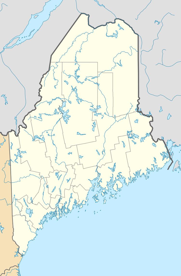
- Map of Cambridge ME USA
- Geography
- 2010 census
- 2000 census
- History
- References
Map of Cambridge, ME, USA
Geography
According to the United States Census Bureau, the town has a total area of 19.38 square miles (50.19 km2), of which, 19.32 square miles (50.04 km2) of it is land and 0.06 square miles (0.16 km2) is water.
2010 census
As of the census of 2010, there were 462 people, 197 households, and 136 families residing in the town. The population density was 23.9 inhabitants per square mile (9.2/km2). There were 252 housing units at an average density of 13.0 per square mile (5.0/km2). The racial makeup of the town was 97.4% White, 0.4% Native American, 0.6% Asian, and 1.5% from two or more races. Hispanic or Latino of any race were 1.5% of the population.
There were 197 households of which 23.9% had children under the age of 18 living with them, 57.4% were married couples living together, 8.1% had a female householder with no husband present, 3.6% had a male householder with no wife present, and 31.0% were non-families. 21.8% of all households were made up of individuals and 8.1% had someone living alone who was 65 years of age or older. The average household size was 2.35 and the average family size was 2.70.
The median age in the town was 48.3 years. 17.5% of residents were under the age of 18; 5.4% were between the ages of 18 and 24; 21.6% were from 25 to 44; 37.8% were from 45 to 64; and 17.5% were 65 years of age or older. The gender makeup of the town was 49.6% male and 50.4% female.
2000 census
As of the census of 2000, there were 492 people, 193 households, and 147 families residing in the town. The population density was 25.4 people per square mile (9.8/km²). There were 229 housing units at an average density of 11.8 per square mile (4.6/km²). The racial makeup of the town was 99.19% White, 0.41% African American, 0.20% from other races, and 0.20% from two or more races. Hispanic or Latino of any race were 0.20% of the population.
There were 193 households out of which 31.6% had children under the age of 18 living with them, 67.4% were married couples living together, 3.6% had a female householder with no husband present, and 23.8% were non-families. 19.7% of all households were made up of individuals and 5.7% had someone living alone who was 65 years of age or older. The average household size was 2.55 and the average family size was 2.86.
In the town, the population was spread out with 23.6% under the age of 18, 6.5% from 18 to 24, 26.2% from 25 to 44, 29.3% from 45 to 64, and 14.4% who were 65 years of age or older. The median age was 41 years. For every 100 females there were 100.0 males. For every 100 females age 18 and over, there were 100.0 males.
The median income for a household in the town was $28,516, and the median income for a family was $28,942. Males had a median income of $28,438 versus $20,521 for females. The per capita income for the town was $12,624. About 8.9% of families and 13.7% of the population were below the poverty line, including 20.1% of those under age 18 and 2.7% of those age 65 or over.
History
Cambridge was originally part of Ripley, Maine. It was so named by a young girl studying in England. "Bunker" was the original family.