
Country Mexico Area 16,066 km² Local time Monday 9:49 PM | Elevation 1,250 m (4,100 ft) Population 40,221 (2010) | |
 | ||
Weather 18°C, Wind W at 14 km/h, 22% Humidity University TecMilenio University, Camargo | ||
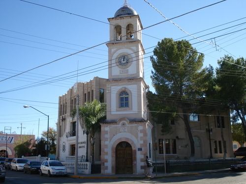
Santa Rosalía de Camargo, originally called Santa Rosalia, and now known as "Camargo City", is a city in the eastern part of the Mexican state of Chihuahua. It serves as municipal seat of Camargo municipality. It is a colonial town steeped in history. The Mission Santa Rosalía has a beautiful park. Camargo is within a short distance from a small pueblo called Chavira, now Chavira is another neighborhood of the city, and a short distance up the road to the old Precidio San Francisco de Conchos near Lake Boquilla and Lake Colina known as places for tourists to come especially in the summer season, as well as Los Filtros.
Contents
- Map of Camargo Chihuahua Mexico
- History
- Climate
- Neighborhoods of Camargo
- Population
- Tourism
- Interesting places to go
- Agriculture
- Fruits of the region
- Ranching
- Schools in Camargo City
- References
Map of Camargo, Chihuahua, Mexico
History
During the Spanish conquest of Mexico, the Spaniards came in and waged war against the Native Conchos Indians who lived there. During the Mexican Revolution, Pancho Villa also invaded Camargo. Other Native tribes such as the Apache Indians came down from the Ojinaga, Chihuahua region not far from El Paso, and waged war against the Conchos Indians. Some used the Rio Grande as well as the Rio Conchos to ride their horses into the region. The River provided water as a source supply for survival. The San Francisco de Conchos area was attacked by various tribes.
The region is known for agriculture, cattle, corn, pecan trees and its surrounding mountains. Camargo is ethnically diverse, but mostly of European origin, composed of Spanish, Basque, Portuguese, French, Italian, German, Mennonites, South African Boers and Conchos Indians. The Tarahumara Indians come into Camargo to sell goods to local people and they live throughout the region and up in the mountains.
Climate
Carmargo has a semi-arid climate (Köppen climate classification BSh) with mild winters and hot summers. The average high in hottest month is 36 °C (97 °F) while the average low is 19 °C (66 °F). Winters are mild with an average high of 20 °C (68 °F) and an average low of 2 °C (36 °F) in January. Precipitation is sparse though it is higher from July to September.
Neighborhoods of Camargo
The Camargo's Municipality has 248 "Colonias" (neighborhoods) and "Zonas Conurbadas" which make the entire city.
Population
As of 2010, the city had a total population of 40,221, up from 39,149 as of 2005.
Tourism
Tourism is a popular activity and a generating potential of currencies, because Camargo City and vicinity possesses a great number of natural attractions, the most popular being:
Interesting places to go
Agriculture
Wheat, sorghum, cotton, soy bean, maize (corn), bean, chili, alfalfa, onion.
Fruits of the region
Nut, grapevine, apricot, watermelon, melon, pear, plum-tree, small peach.
Ranching
Mostly cattle (cows).
Schools in Camargo City
Telesecundaria 6086 Ortegueno