
Max length 25.1 km Population 13,358 (2000) | Area 103 km² | |
 | ||
Width 0.75–6.6 mi (1.21–10.62 km) Pop. density 335.9 /sq mi (129.69 /km) Points of interest Cama Beach State Park, Camano Island State Park, Canopy Tours NW, Freedom Park, English Boom Trail Similar | ||
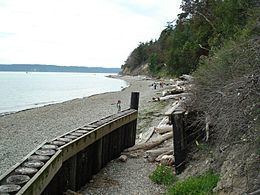
Camano Island /kəˈmeɪnoʊ/ is a large island in the Possession Sound portion of Puget Sound, located in Island County, Washington, between Whidbey Island and the mainland. The body of water separating Whidbey Island and Camano Island is called Saratoga Passage. Camano Island is separated from mainland Snohomish County by Davis Slough near the city of Stanwood. The island is reached via State Route 532 over the Camano Gateway Bridge in the northeast of the island.
Contents
- Map of Camano Island WA 98282 USA
- 133 valdes ct camano island wa 98282 mls 822908
- Name originEdit
- EventsEdit
- References
Map of Camano Island, WA 98282, USA
There were 13,358 residents on the island as of the 2000 census, but the population peaks at 17,000 during the summer months with retired "snowbirds." The island has a total land area of 102.99 km² (39.77 sq mi), though it was larger before the Great Slide of 1825.
During the Last Ice Age the island, sound and land surrounding the sound was covered by a mile thick sheet of ice. As temperatures rose the glacier receding carving the island and leaving behind deposits of glacial till.
133 valdes ct camano island wa 98282 mls 822908
Name originEdit
Camano Island is named for the Spanish explorer Jacinto Caamaño. The original name of the island was Kal-lut-chin which in the language of the indigenous Snohomish tribe meant "land jutting into a bay". They used the island as a base during the fishing and shellfish gathering expeditions. Charles Wilkes, during the Wilkes Expedition of 1838–1842, named it MacDonough Island in honor of Thomas MacDonough for his victory of the Battle of Lake Champlain during the War of 1812. Following this theme, Wilkes named the body of water between Camano and Whidbey Island after MacDonough's flagship the Saratoga. When Henry Kellett reorganized the official British Admiralty charts in 1847, he removed Wilkes' name MacDonough and bestowed the name Camano, which the Spanish had originally given to Admiralty Inlet in 1790. Wilkes' name Saratoga Passage was retained.
Jacinto Caamaño explored much of the Pacific Northwest going as farth north as what is now Alaska for the Spanish. He began his expedition far to the south in San Blas, Mexico. In addition to its Snohomish name the island has also been known as Macdonough Island named for Thomas Macdonough a U.S. Navy officer during the War of 1812 and as Perry Island after an 1855 treaty between local Native Americans and Washington Territory governor Isaac Stevens. The first Euro-American settlers on the island arrived at the time of the signing of the treaty. Lastly the island was called Crow Island during the logging era that took place during the early 1900s.