
Country Philippines Barangays ZIP code 4502 Province Albay | District 2nd district Time zone PST (UTC+8) Area 130.9 km² | |
 | ||
Region Bicol Region (Region V) Neighborhoods Baligang, Gotob, Libod, Anoling, Cotmon, Bariw | ||
Quitinday green hills camalig albay
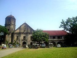
Camalig, officially the Municipality of Camalig (Central Bikol: Banwaan kan Camalig; Filipino: Bayan ng Camalig), is a municipality in the province of Albay in the Bicol Region (Region V) of the Philippines. The population was 66,904 at the 2015 census. In the 2016 electoral roll, it had 37,655 registered voters.
Contents
- Quitinday green hills camalig albay
- Map of Camalig Albay Philippines
- Geography
- Barangays
- Demographics
- References
Map of Camalig, Albay, Philippines
In 1952, there was a mass conversion of certain sitios into barrios, namely: Anoling, Binanderahan, Cabraran Pequeño, Ilawod, Mabugna, Magogon, Quinuartilan, Solong, and Sumlang.
Geography
Camalig is located at 13°08′N 123°40′E.
According to the Philippine Statistics Authority, the municipality has a land area of 130.9 square kilometres (50.5 sq mi) constituting 7000508000000000000♠5.08% of the 2,575.77-square-kilometre- (994.51 sq mi) total area of Albay.
Barangays
Camalig is politically subdivided into 50 barangays.
Demographics
In the 2015 census, Camalig had a population of 66,904. The population density was 510 inhabitants per square kilometre (1,300/sq mi).
In the 2016 electoral roll, it had 37,655 registered voters.