
Incorporated 1912 Area 2.98 km² Local time Monday 8:33 PM | Township Calumet ZIP code(s) 60643, 60827 Population 7,913 (2013) Area code 708 | |
 | ||
Weather 16°C, Wind S at 37 km/h, 83% Humidity | ||
Calumet Park (formerly DeYoung) is a village in Cook County, Illinois. The population was 7,835 at the 2010 census.
Contents
Map of Calumet Park, IL, USA
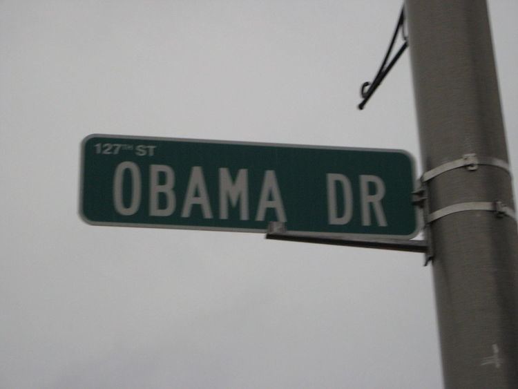
On May 13, 2010, Mayor Joseph DuPar and the Village Board approved renaming 127th Street as Obama Drive, in honor of the 44th President of the United States. On August 21, 2010, State Senator Emil Jones III read a proclamation of the Illinois Senate in honor of the dedication on the same date. This road became the first Obama Drive in the country and the first road named after President Obama in his home state of Illinois.
Geography
Calumet Park is located at 41°39′56″N 87°39′29″W (41.665602, -87.658139).
According to the 2010 census, Calumet Park has a total area of 1.146 square miles (2.97 km2), of which 1.11 square miles (2.87 km2) (or 96.86%) is land and 0.036 square miles (0.09 km2) (or 3.14%) is water.
Demographics
As of the 2000 census, there were 8,516 people, 2,991 households, and 2,150 families residing in the village. The population density was 7,695.4 people per square mile (2,962.2/km²). There were 3,173 housing units at an average density of 2,867.2 per square mile (1,103.7/km²). The racial makeup of the village was 12.14% White, 82.88% African American, 0.31% Native American, 0.07% Asian, 0.01% Pacific Islander, 3.08% from other races, and 1.51% from two or more races. Hispanic or Latino of any race were 7.74% of the population, including 7.0% of Mexican descent.
There were 2,991 households out of which 34.9% had children under the age of 18 living with them, 38.4% were married couples living together, 26.8% had a female householder with no husband present, and 28.1% were non-families. 23.8% Of all households were made up of individuals and 6.2% had someone living alone who was 65 years of age or older. The average household size was 2.85 and the average family size was 3.37.
The village's population was distributed with 29.3% under the age of 18, 10.2% from 18 to 24, 28.1% from 25 to 44, 24.3% from 45 to 64, and 8.1% who were 65 years of age or older. The median age was 32 years. For every 100 females there were 88.2 males. For every 100 females age 18 and over, there were 83.1 males.
The median income for a household in the village was $45,357, and the median income for a family was $49,958. Males had a median income of $38,806 versus $31,318 for females. The per capita income for the village was $18,283. About 10.2% of families and 11.5% of the population were below the poverty line, including 14.4% of those under age 18 and 11.0% of those age 65 or over.
Government
Calumet Park is divided between two congressional districts. The area east of Interstate 57 and south of 123rd Street is in Illinois' 2nd Congressional District; the rest of the village is part of the 1st Congressional District.