
- land 0.30 sq mi (1 km) - summer (DST) CDT (UTC-5) Area code 504 | - water 0.00 sq mi (0 km), 0% Area 78 ha | |
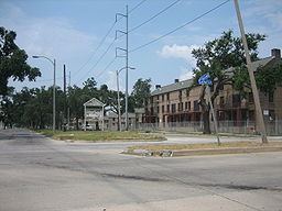 | ||
Master p and calliope var in the calliope projects 2013
The Calliope Projects also known as B.W. Cooper is a neighborhood of the city of New Orleans and one of the housing projects of New Orleans, more commonly known by its former name, the Calliope Projects. This project of New Orleans gained nationwide fame/infamy for its extremely high violent crime rate and was known to be the most violent project in Central City, New Orleans. It was completely demolished in 2014 and replaced with newer, mixed-income apartment buildings.
Contents
- Master p and calliope var in the calliope projects 2013
- Map of B W Cooper New Orleans LA USA
- Geography
- Adjacent Neighborhoods
- Boundaries
- Demographics
- History
- Notable residents
- References
Map of B. W. Cooper, New Orleans, LA, USA
Geography
The Calliope Projects are located at 29°57′02″N 90°05′32″W and have an elevation of 0 feet (0.0 m). According to the United States Census Bureau, the district has a total area of 0.30 square miles (0.8 km2). 0.30 square miles (0.8 km2) of which is land and 0.00 square miles (0.0 km2) (0.0%) of which is water.
Adjacent Neighborhoods
Boundaries
The City Planning Commission defines the boundaries of the B. W. Cooper neighborhood as: Pontchartrain Expressway, South Claiborne Avenue, Martin Luther King Boulevard and South Broad Street.
Demographics
As of the census of 2000, there were 4,339 people, 1,421 households, and 1,139 families residing in the neighborhood. The population density was 14,463 /mi² (5,424 /km²).
As of the census of 2010, there were 806 people, all black, 318 households, and 181 families residing in the neighborhood.
History
Officially called the B. W. Cooper apartments, the Calliope Projects (pronounced by New Orleans natives as KAL-ee-ope or sometimes KAL-lee-oh) is one of the Housing Projects of New Orleans located in Central City New Orleans. There are 1,546 units on 56 acres (230,000 m2) of land (or 24 city blocks.)
The project was built between 1939 and 1941. The original boundaries were South Dorgenois, Erato, Calliope (now Earhart Boulevard) and South Prieur Streets. In 1941, rents ran from $8.25 a month for a one bedroom apartment to $22.00 a month for a three bedroom. Until the projects were built, the buildings in the neighborhood were one- or two-story wooden shot-gun structures for the most part. The projects were sturdily made of brick with iron grill trimmings and manicured lawns. The floor plans of the project apartments allowed for more privacy for bedrooms than the traditional neighborhood residences.
During the Calliope's early days, it was considered a means for working-class families to live comfortably, while saving up the funds to purchase their own homes. St. Monica's Catholic Church and School were considered anchors of the neighborhood, along with the local public schools like Booker T. Washington High School. Along with a steady stream of outstanding musicians, the neighborhood produced educators, including a Superintendent of Orleans Parish Schools, and politicians, who served city and state government.
There are 690 apartments in the original development. In 1949, a gymnasium was added at Broad and Calliope Streets. In 1954, a twelve block expansion added 860 new units. The expansion pushed the western boundary of the Calliope back two blocks from Erato Street to Melpomene Avenue (now Martin Luther King, Jr. Boulevard).
In May 1981, the Calliope was renamed the B.W. Cooper Apartments. Mr. Cooper worked for the Housing Authority of New Orleans for 33 years and served on several civic and social organizations until his death in 1974.
In 1994 the Calliope Projects was the most bloodiest housing project in Uptown New Orleans and the United States along with the Magnolia Projects and Melpomene Projects. The drug trade and subsequent violence from it were two of the primary reasons New Orleans was nicknamed the "Murder Capital of the United States" (a dubious, year-end title given to the city in the U.S. with the highest per capita homicide rate - murders for every 1,000 people - the previous year) throughout the early & mid 1990s. Since the early 1980s, rival drug dealing street gangs have operated in & around the Calliope area, spawning what the law enforcement community in New Orleans called "a seemingly nonstop cycle of retaliatory violence."
The projects are in the 2nd Ward (map).
Most of Calliope is closed due to demolition. In January 2007, a small section of the Calliope had been reopened to residents.
A "newer" BW Cooper development was opened in 2012, and was renamed Marrero Commons. With 175 units, it was named for Yvonne Marrero, a community leader and former president of the Cooper Resident Management Corporation.