
 | ||
Similar | ||
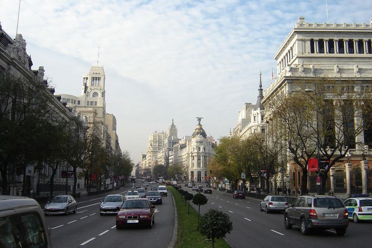
Calle de Alcalá is the longest street in Madrid. It starts at the Puerta del Sol and goes on for 10.5 km, to the northeastern outskirts of the city. Henry David Inglis described it in 1837 as "long, of superb width, and flanked by a splendid range of unequal buildings". Calle de Alcalá is one of the oldest streets in the city. It was the old road which led to the city of Alcalá de Henares (from which it takes the name) and continued to Aragón; today, this route is covered by the A-2 motorway. Along this street it is possible to find landmarks such as Banco Bilbao Vizcaya at number 16, the former Alcalá 20 discothèque at number 20, Edificio Metrópolis, the Unión y el Fénix Español building at number 23, Círculo de Bellas Artes, Plaza de Cibeles, Puerta de Alcalá, the Spanish Ministry of Education, the Instituto Cervantes HQ building, the Bank of Spain building, Parque del Buen Retiro and Plaza de Toros de Las Ventas.
Contents
- Map of Calle de AlcalC3A1 Madrid Spain
- Por la calle de alcal antolog a de la revista
- In popular culture
- References
Map of Calle de Alcal%C3%A1, Madrid, Spain
Por la calle de alcal antolog a de la revista
In popular culture
Por la calle de Alcalá was a popular cuplé describing a florist selling tuberoses (polianthes tuberosa) on the street.